
Kettle Moraine State Forest Remote Sensing Forest Inventory
Enhancing WisCFI Plot Data With Stand-Wide Remotely Sensed Forest Inventory Data
Project Summary
Overview
The Wisconsin Continuous Forest Inventory (WisCFI) manually samples plots on Wisconsin state forests to estimate the quantity of trees and species distribution at the property level. While this approach is time-tested, new methods of collecting inventory data are being developed using remote sensing data captured with unmanned aerial vehicles (UAV) and fixed wing aircraft. This project will test and demonstrate the capacity of UAV-based LiDAR and hyperspectral imagery to inventory a portion of the Southern Kettle Moraine State Forest that includes several CFI plot locations. Results from this project will show if and how these new technologies can be used to supplement and enhance our current manual inventory processes.
Management Implications
While WisCFI sampling is intense compared to many forest inventory approaches, the inherent uncertainty in projecting results from small samples to large areas limits its application to detecting and identifying long-term general trends. However, new methods of collecting remote sensing data are in development that can potentially inventory entire stands in a similar time that it takes to collect several WisCFI plots. From this, the highly detailed measurements taken in the WisCFI can be leveraged against the larger spatial extent of the UAV inventory data to identify more fine-grained and complex features of our state forests. This project aims to quantify the variability in CFI plots and identify ways in which remote sensing data can add value to our existing WisCFI efforts.
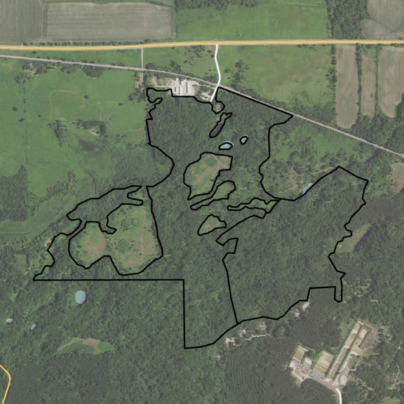
Study Area
This study will take place on two stands located in the Southern Kettle Moraine State Forest adjacent to the forest headquarters in Palmyra, Wis. Each stand is an oak cover type and contains one WisCFI plot each of which has been sampled since 2007 every five years. LiDAR data will be captured at a 200+ points/meter density using a UAV platform piloted by UW-Madison (UW) staff. Hyperspectral imagery will be captured by UW staff with an instrument mounted in a Wisconsin DNR plane. Once data collection is complete, it will be compiled by UW staff and analysis will be completed by DNR Forestry Research staff.
Timeline
Imagery Acquisition: Late Summer 2026
Expected Completion Date: Fall 2027
Project Partners and Support
Funded By: Wisconsin DNR, Division of Forestry
Principle Investigator: Bob Smail, DNR Forestry Research Scientist
Internal and External Partners: University of Wisconsin Madison – Department of Forest and Wildlife Ecology