
Protection Best Practices Toolkit
Overview
The DNR and partners can leverage the Wonderful Waters of Wisconsin (WWOW) Action Plan and Healthy Watersheds, High-Quality Waters (HWHQW) modeling and assessment information to further protection activities. To support this effort, the Action Plan identified the development of a protection toolkit to help support permanent land protection, forested watershed conservation, natural flood management and other innovative approaches to protect future land and water resource uses. This toolkit will be a living document that is updated as research and technical resources advance.
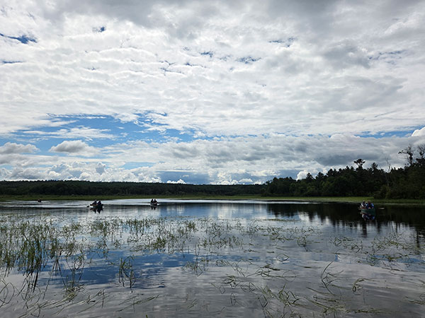
Protect Land
The WWOW Action Plan identifies protection priority watersheds with greater than 75% natural land cover as the primary target for a land protection strategy. Land protection is the primary mechanism for maintaining watershed health since it preserves critical ecosystem services in perpetuity without replacement, maintenance or significant capital improvement costs often associated with restoration practices.
Stay Vigilant
- In watersheds where natural land cover is permanently protected, vigilance is required to ensure water quality and land use best practices are followed to adequately protect high-quality water resources. Protected lands held by the federal government, state agencies and nonprofit conservancies can be found using the USGS PAD-US website. For privacy purposes, private landowner held conservation easements may not be published.
- Develop, implement and renew land management plans that set objectives for maintaining or restoring the property. Land management plans often include water quality best practices, protocols for monitoring the health of natural communities and goals for reducing or preventing encroachment and high intensity land uses.
- Partner with state and federal agencies to care for public lands. In Wisconsin, conservation organizations and friends groups can officially adopt a fish or wildlife area, participate in community science surveys or join a volunteer work day at a state natural area.
Maximize Water Quality Benefits
- When identifying land to protect that will have the highest water quality benefits, consider prioritizing the following criteria:
- Riparian zones with well-established natural vegetation, including trees and shrubs
- Headwater streams and wetlands to maximize downstream benefits
- Large tracts of intact natural land cover, especially wetlands and forests
- Land that is naturally prone to erosion, such as steep slopes and bluffs, streambanks and areas with bare soils
- Proximity to public protected lands with the goal of maintaining large corridors of undeveloped land to support water quality and fish and wildlife habitat.
- Additional resources can be found within the EPA's Advancing Watershed Protection Through Land Conservation: A Guide for Land Trusts.
Explore The Right Land Protection Strategy
- Common examples of land protection strategies include fee-title acquisitions, conservation easements and protective covenants. The Wisconsin Model Conservation Easement, created by Gathering Waters, is a resource designed to streamline the process of drafting an easement, promote best practices and is customized for Wisconsin’s unique laws and regulations.
- Land protection options often include flexibility to preserve outdoor recreational activities and to maintain or build infrastructure with sensitivity to the resources. Successful projects prioritize building a strong relationship with the landowner and ensuring that their land use goals are considered.
- The DNR's Surface Water Grant program can fund land acquisition or conservation easements that protect lakes, rivers and their ecosystems in perpetuity. The DNR's Streambank Protection Program targets premier stream fisheries that are threatened by agricultural and urban runoff through conservation easements.
Connect With Local Land Trusts And Conservancies
- Determine what land protection programs are eligible within the watershed and where strategic priorities overlap for habitat, recreation and water quality.
- Wisconsin is fortunate to have over 40 land trusts dedicated to protecting our land and water! To find a land trust near you, visit the Gathering Waters website. Where feasible, use of an accredited land trust with real estate and legal expertise is encouraged.
Enhance Natural Land Cover
When 75% or more of the watershed is covered by natural land, including wetlands, grasslands and forests, water quality and aquatic habitat support healthy fisheries, wildlife communities and recreational uses. To learn more about the connection between natural land cover and water quality, check out the Protecting Forests For Water Quality (2024) report from the Open Space Institute, the MN Fisheries Strategic Plan – Habitat Framework for Lakes (2013) or visit the EPA's Healthy Watersheds Protection website.
Protect And Restore Shorelands
- Promote an “au naturel” approach to shoreland living – stop mowing in the 35’ buffer zone, leave fallen trees and branches in the water and don’t remove aquatic vegetation. Natural shorelines help stabilize soils, protect water quality and support habitat needs for 90% of aquatic species and 70% of terrestrial species at some point in their life cycle.
- Maintain three layers of vegetation (wildflowers/grasses, shrubs and trees) along waterways to provide maximum water quality benefits. Trees and shrubs are critical for providing canopy shade that can preserve thermal conditions and habitat for fish and aquatic life.
- Wisconsin’s Healthy Lakes & Rivers initiative provides technical assistance and funding to install five simple and inexpensive shoreland best practices that reduce runoff, create habitat and protect water quality. Join the 1,100+ landowners who have installed a practice since 2015.
- DNR Surface Water Grants can provide funding for Healthy Lakes & Rivers practices and large-scale lake or river restoration projects. Reach out to your local lake or streams biologist to see which grant category might be the best fit.
Maintain Healthy Forests And Promote Reforestation
- Restore and regenerate forest land in DNR priority protection watersheds, especially those with <75% natural land cover.
- Put your newly planted trees on the map. As part of the Trillion Tree Pledge, Wisconsin has committed to planting 100 million trees by 2030. Healthy forests are essential to mitigating climate change and offer numerous benefits for the health of our watersheds and communities.
- My Wisconsin Woods connects landowners to local foresters who can complete field visits and develop forest stewardship plans with the goal of improving habitat, addressing erosion, managing nonnative plants and insects and protecting water quality. Plan preparation and implementation can also be funded through the Wisconsin Forest Landowner Grant Program.
- Consider planting tree and shrub species well suited for climate adaptation using the USDA Forest Service - Forest Ecosystem Atlas. The newly updated tool considers biological and disturbance factors that estimate a species ability to cope under new climate scenarios.
Identify Opportunities For Land Conversion And Enhancement
- No planting is too small. Plant a variety of deep-rooted native flowers, grasses, trees and shrubs in place of turf in residential areas, urban greenspaces and parks. See the DNR's Native Plant webpage for a list of native plant sales and vendors near you.
- Develop a county tree/shrub sale or expand existing selection to include native seed mixes and kits for shorelines and raingardens. Promote tree sales to shoreland landowners.
- In addition to traditional soil health practices, integrate perennial vegetation and tree/shrub plantings into agricultural conservation practices. Practices include conservation cover, harvestable buffers and riparian buffers.
- Identify marginal farmland and open lands that are less suitable for production and convert them to natural land cover appropriate for the region. The USDA CroplandCROS tool allows users to compare annual cropland usage and land cover percentages within a defined area.
Restore Hydrology
Resilience based restoration is sometimes necessary within healthy watersheds to preserve critical ecosystem services that restore hydrologic connectivity, improve aquatic organism passage and assist with flood management, amongst other goals. In the context of protection, these strategies are focused on restoring function in areas where waterbodies are still healthy.
Inspect And Right-Size Infrastructure
- Inventory road-stream crossings to identify infrastructure at high risk for erosion and failure. The Great Lakes Stream Crossing Inventory utilizes a standard protocol to assess road-stream crossings, upload their data and easily compare crossings by location.
- Replace and right-size road stream crossing infrastructure using stream-simulation design principles that improve stream flow, fish and aquatic organism passage, and flood resiliency. The Wisconsin Initiative on Climate Change Impacts Infrastructure Working Group published a design primer and detailed guidance document for flood resilient culvert and bridge design.
- Evaluate where in-stream structures may be leading to hydrologic alterations, such as increased stream flow and ponding of wetlands, and causing erosion. In Wisconsin, remnant logging-era dams may be a good candidate for removal and stream restoration. The DNR can provide financial assistance to private landowners and municipal dam owners who are interested in dam removals or modifications.
Focus On Wetlands
- Wetlands provide vast ecosystem services (e.g. flood abatement, sediment retention, nutrient transformation, etc.) that are of great personal and economic benefit to humans and wildlife. The Watershed Health Index includes metrics to assess wetland ecosystem services at the HUC12 watershed scale and can be explored within the Watershed Restoration & Protection Viewer. This data was sourced from Wetlands by Design.
- Identify and protect high-functioning wetlands using the DNR's High-Quality Wetlands dataset. This dataset reflects both rare and unique wetlands that have been surveyed by the DNR Natural Heritage Conservation program or have a floristic quality assessment that met criteria for good-to-excellent condition. Please note that this dataset provides point data and should be utilized in coordination with state and national wetland mapping inventries.
- Where wetlands have been lost, the Cumulative Wetland Ecosystem Services Loss metric within the DNR Watershed Vulnerability Index can be used to narrow down watersheds (HUC12) where restoration might be most beneficial. Within those watersheds, use the Wisconsin Wetlands & Watersheds Explorer (The Nature Conservancy) to identify locations across the state that were once drained and represent good candidates for wetland restoration.
- Learn how to assess wetland condition and function. Unlike surface water monitoring, plants and soil are the most commonly used indicators for evaluating wetland health. The DNR's Wetland Assessment webpage includes guidance for multiple monitoring protocols varying in intensity and technical expertise for permitting, conservation and planning purposes.
- When developing plans or designing a project, give wetlands the same due diligence as lakes, rivers and streams. The EPA created the Incorporating Wetlands Into Watershed Planning (2012) guidance document to address this common gap in planning.
Capture Runoff And Prevent Erosion
- Capture water where it lands. Divert and infiltrate all stormwater runoff to protect high-quality waters from sediment, phosphorous, fecal bacteria and other harmful pollutants. Even in predominantly healthy watersheds, areas with erosion prone soils, steep slopes, aging road-stream crossings and impervious surfaces near waterways can be significant sources of sediment.
- Where possible, natural flood management techniques should be utilized to restore or mimic ecosystem services provided by healthy and resilient watersheds. The Review And Recommendations For Slow The Flow Practices In Wisconsin’s Lake Superior Basin (DNR 2022) provides a watershed-scale strategic approach for restoring hydrology and increasing flood resiliency across wetland, forested, agricultural and urban land uses.
- In shoreland areas, adhere to shoreline zoning standards, minimize impervious surfaces and consider installing a Healthy Lakes & Rivers best practice to divert, capture and infiltrate runoff. Practices like raingardens can offer both water quality and habitat benefits.
- Follow forestry water quality best management practices to minimize disturbance, control erosion and prevent impacts to hydrologic connectivity. When possible, go above and beyond minimum requirements when working next to high-quality water resources (e.g. wider riparian management zones for wetlands and waterbodies).
- During any construction, follow all stormwater and sediment control measures to comply with NR 151. The DNR website provides detailed information on technical standards and stormwater best practices.
Plan For the Future
Watershed health is vulnerable to land use changes that increase runoff, decrease natural land cover, impact natural hydrology and introduce sources of pollution on the landscape. Planning with protection in mind can ensure that development, agriculture and recreational uses can occur with minimal impacts to healthy waters. The following practices can be used in conjunction with the Conservation Planning Tools found on the DNR Healthy Watersheds, High-Quality Waters webpage.
Integrate WWOW Action Plan Priorities Into Planning Efforts
- Include WWOW protection priorities in 9 Key-Element watershed plans, land and water resource management plans, regional water quality plans, strategic land conservation plans and more. Healthy Watersheds, High-Quality Waters data can be integrated into resource assessments and used to frame plan goals, objectives and monitoring targets.
- Pilot a watershed protection plan. The DNR is developing protection planning guidance that meets the EPA’s Alternative Watershed Planning criteria and provides a complementary framework for maintaining healthy waters compared to traditional watershed restoration plans.
- Engage with the DNR’s Green Tier program on water quality planning efforts and best practices. Consider joining Green Tier or partnering with a participant on water quality protection projects. Green Tier members are sustainability leaders (businesses, municipalities, nonprofits, etc.) working to make systematic environmental improvements.
Incentivize Private Landowner Participation
- Promote long-term shoreland protection. Examples include the Burnett County Shoreland Incentive Program, which provides tax incentives to landowners who choose to protect their shoreline through deed restrictions and complete restorations where necessary.
- Enroll private forested land into carbon tax credit programs that incentivize the growth of mature forests and reduce timber harvesting.
- The Natural Resource Conservation Service offers numerous incentive programs to Wisconsin landowners and producers to enroll working lands in conservation programs to protect water quality, improve soil health and create habitat.
Leverage Ordinances And Zoning To Advance Protection
- Consider ordinances that will help to enhance natural land cover or improve water quality, such as using green spaces for native pollinator habitat, creating source water protection areas, increasing and diversifying the urban tree canopy and reducing road salt usage.
- Develop communications to emphasize the value of shoreland zoning (i.e. setbacks, buffer depth, tree preservation, septic maintenance, etc.)
- Explore the use of conservation design for subdivision and community zoning to maximize natural spaces, lower maintenance costs and decrease the impacts of runoff.