Lower Fox River Basin TMDL
A framework for water quality improvement
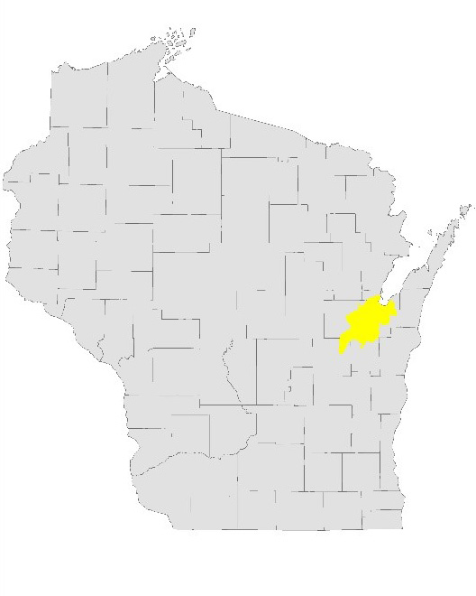
The Lower Fox River basin is located in northeast Wisconsin and includes portions of Brown, Calumet, Outagamie and Winnebago counties and the Oneida Nation. The Lower Fox River basin is roughly the 640 square mile drainage area (HUC8 04030204) located between Lake Winnebago and Green Bay in which all surface water drains to Green Bay.
About The Lower Fox River Basin
Land use in the Lower Fox River basin is diverse but consists primarily of agriculture, urban development and natural areas. The land use directly impacts water quality. Municipal and industrial discharges to streams and rivers in the Lower Fox River basin and surface water runoff from the land due to rain events and snowmelt carry sediment and nutrients to streams and rivers.
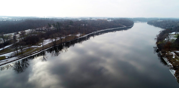
The primary surface waters within the Lower Fox River basin include the Lower Fox River (39 miles), Lower Green Bay and 14 main tributaries. Due to excessive levels of total phosphorus and total suspended solids, many of these bodies of water are listed as impaired because they do not meet state water quality standards (see map under Total Maximum Daily Load resources). The amount of total phosphorus and total suspended solids from point sources (dischargers) and non-point sources (runoff) delivered to our waters in the Lower Fox River basin are detailed in the 2012 Total Maximum Daily Load Report (see below).
Excessive amounts of total phosphorus and total suspended solids in surface waters cause water clarity problems, nuisance algae growth, oxygen depletion, warmer water temperatures, reduced aquatic vegetation and degraded habitat. These impairments may adversely impact human health, recreation, water quality, fish and wildlife habitat, recreation and tourism economy and potentially navigation.
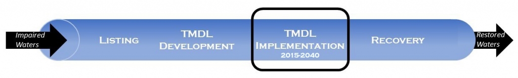
Total Maximum Daily Load Implementation
The overall goal of total maximum daily load implementation is to meet water quality standards and provide meaningful water quality improvements by reducing total phosphorus and total suspended solids loadings in the Lower Fox River basin by 59% and 55%, respectively.
Point Source Dischargers
Through compliance with their Wisconsin Pollutant Discharge Elimination System permits, the 28 dischargers in the Lower Fox River basin will meet total maximum daily load limits resulting in the reduction of 108,000 pounds of total phosphorus over the next 20 years in the Lower Fox River basin.
Municipal Separate Storm Sewer Systems
Through compliance with their Wisconsin Pollutant Discharge Elimination System Municipal Separate Storm Sewer Systems (MS4) General Permit, the 29 regulated municipalities in the Lower Fox River basin will result in 23,500 pounds of total phosphorus reduced and 10,210,000 pounds of total suspended solids reduced in 20 years.
Agriculture (CAFO And Non-CAFO)
The total maximum daily load target for agriculture in the Lower Fox River basin is the reduction of 196,748 pounds of total phosphorus and 55,570,968 pounds of total suspended solids.
- Baseline Agricultural TP And TSS Unit Loads by Watershed [PDF]
- Nine Key Element Plan And Implementation Status
- Agricultural TP And TSS Reductions by Watershed [PDF]
- Lower Fox Agriculture Implementation Strategy [PDF]
Monitoring And Evaluation
- Lower Fox River Long-Term Trend Water Quality
- Lower Fox River Basin Tributary Monitoring
- Lower Fox River Basin Volunteer Monitoring Program
2015 Watershed Assessments - pre-implementation chemical and biological health assessments of 15 watersheds to serve as the baseline.
Total Maximum Daily Load Resources
- TMDL Report
- Map Of Lower Fox TMDL Basin With Impaired Waters
- Spatial Data [ZIP]
- Watershed Restoration and Protection Viewer - WI River TMDL