Green Bay West Shores Wildlife Area
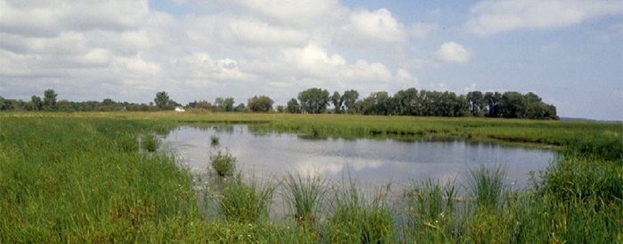
The Green Bay West Shores Wildlife Area (GBWSWA) is located along the west shore of Green Bay. The west shore has a long history of human occupation. Rivers and the shoreline were used by Native Americans who utilized the resources of the bay and adjacent land. Missions and trading posts were established at several locations on the shore beginning during the French settlement of the area in the 1700s and continuing throughout British and American settlement in the 1800s. The area was logged with lumber mills located at Peshtigo, Oconto and Pensaukee. The west shore supported a commercial fishing industry which continues to the present on a much smaller scale. In some areas, agriculture followed land clearing though poorly drained soils and water level fluctuations present challenges.
Interest in government involvement of conservation of the West Shore began in the 1930s with establishment of a National Wildlife Refuge on Longtail Unit which was eventually terminated and turned over to the state for inclusion in the wildlife area. State acquisition of land along the west shore began in 1948 in the Sensiba Unit. Other units were established in 1954 (Peshtigo Harbor), 1956 (Pensaukee), 1962 (Rush Point), 1965 (Charles Pond) and 1967 (Oconto Marsh). In 1965, all west shore properties in Marinette and Oconto counties were placed under one project. In 1978, the project was expanded to include state acquisition of relevant properties within Brown County. Management has focused on wildlife habitat and wildlife based recreation with emphasis on waterfowl, wetland-dependent wildlife, migratory birds and forest game species.
Because the shore zone is vitally important to the fish assemblage of Green Bay, properties have been acquired under authority of the Scattered Fishery Habitat acquisition project. These sites have a hydrologic connection to the bay and provide fish spawning and nursery habitat for a variety of fish species, particularly northern pike. Protection of these sites and enhancement of fish habitat and spawning substrate are the primary fish management activities.
Management units of the 9000-acre Green Bay West Shores Wildlife Area
- Charles Pond Unit located in Oconto County, about nine miles southwest of the town of Pensaukee and includes Charles Pond State Natural Area (SNA).
- Bayside Road Unit located in Brown County, about three miles north of the village of Suamico. Little Tail Point is privately owned.
- Long Tail Unit located in Brown County, about one mile east of the village of Suamico, south of the Suamico River.
- Oconto Marsh Unit located in Oconto County, about one mile northeast of the city of Oconto.
- Peats Lake Unit located in Brown County, about one mile north of the city of Green Bay.
- Pecor Point Unit located in Oconto County, about two miles northeast of the town of Pensaukee.
- Pensaukee Unit located in Oconto County, just south of the town of Pensaukee.
- Peshtigo Harbor Unit located in Marinette County, at the mouth of the Peshtigo River and upstream along both sides of the river. Peshtigo Harbor Lacustrine Forest State Natural Area and Peshtigo River Delta Marshes State Natural Area are located within this unit. The Bloch Oxbow State Natural Area is connected to this unit.
- Rush Point Unit located in Oconto County, north of the city of Oconto.
- Sensiba Unit located in Brown County, about one mile east of the village of Suamico, north of the Suamico River.
- Tibbett - Suamico Unit located in Oconto County, about one mile east of the town of Little Suamico.

Find out more about how to adopt this wildlife area.