Contact: DNR Office of Communications
DNRPress@wisconsin.gov
Governor Evers Signs Emergency Order Relating To Elevated Fire Risk Across Wisconsin
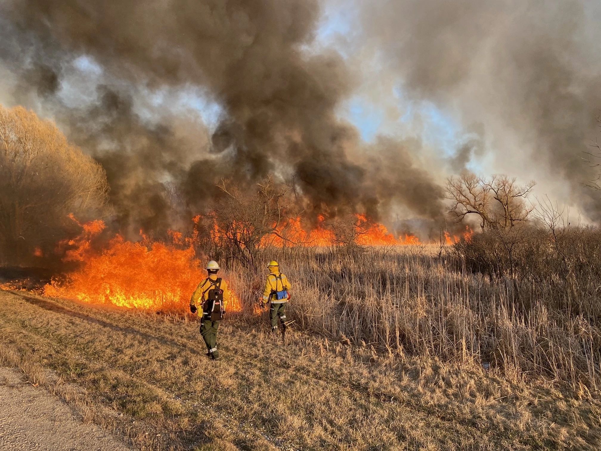
 Wisconsin DNR fire crews fighting a wildfire in Menomonee Falls that burned nearly 450 acres of marshland on Friday, and has since been contained. Wisconsin is at very high fire danger today.
Photo credit: Wisconsin DNR (Marc Sass, DNR Cooperative Area Forest Ranger)
MADISON, Wis. – Gov. Tony Evers today signed Executive Order #110 declaring a State of Emergency in response to elevated wildfire conditions throughout Wisconsin.
Today, all of Wisconsin is at very high fire danger. The combination of dry vegetation, unseasonably warm temperatures, low relative humidity and increasing south or southeast winds will lead to continued elevated fire weather conditions.
The Executive Order will allow wildfire suppression support from the Wisconsin National Guard and assist with rapidly mobilizing the Guard’s Black Hawk helicopters to the areas of the state in most need of aerial fire suppression resources during the spring fire season which generally lasts through May. Executive Order #110 also directs all Wisconsin state agencies to assist as appropriate in wildfire prevention, response and recovery efforts.
Due to the elevated fire risk across the state, burning remains suspended with DNR-issued annual burning permits for debris piles, barrels and grass or wooded areas across the DNR Protection Area. If you are outside the DNR Protection Area, please check with your local authorities for any burning restrictions.
There have already been more than 320 wildfires reported in Wisconsin so far this year, burning over 1,400 acres. Fire officials anticipate a slightly longer than average fire season due to early snow melting around the state.
Any fire could quickly start and spread in these conditions. To help us keep Wisconsinites safe, the DNR is asking you to avoid all outdoor burning including limiting the use of campfires and making sure to extinguish and dispose of cigarettes properly.
Outdoor enthusiasts should also use caution with off-road vehicles or equipment that can create a spark and start a fire. Keep in mind that weather conditions can change frequently and quickly become dangerous.
Report fires early by calling 911 immediately. Regularly check current fire conditions online here.
A copy of the Executive Order is available by clicking here.
 |
The DNR Protection Area includes Adams County, Ashland County, Barron County*, Bayfield County, Burnett County, Chippewa County *, Clark County *, Columbia County, Crawford County, Dane County *, Douglas County, Eau Claire County *, Florence County, Forest County, Grant County *, Green Lake County, Iowa County *, Iron County, Jackson County *, Juneau County, Langlade County, Lincoln County, Marathon County *, Marinette County, Marquette County, Menominee County, Monroe County *, Oconto County *, Oneida County, Polk County *, Portage County, Price County, Richland County, Rusk County, Sauk County, Sawyer County, Shawano County *, Taylor County, Vilas County, Washburn County, Waupaca County *, Waushara County and Wood County*.
Note: Counties with an asterisk (*) are those where only a portion are in the DNR Protection Area.

