Central Sands Lakes Study
In the past several decades, we have witnessed low water levels in water resources throughout the Central Sands, driven by changes in weather and land use. Due to concern about groundwater pumping from high-capacity wells, the DNR collaborated with the Wisconsin Geological and Natural History Survey, United States Geological Survey (USGS) and the University of Wisconsin System to complete the Central Sands Lakes Study in 2021. The study used extensive data collection and groundwater flow modeling to evaluate the impacts of groundwater withdrawals on lake levels for Pleasant, Long and Plainfield Lakes in Waushara County.
- Central Sands Lakes Study Report: Findings And Recommendations (May 2021)
- Findings And Recommendations Overview Presentation
- Central Sands Lakes Study Submittal Letter To Wisconsin Legislature
- Central Sands “By the Numbers” Graphic
- Report Appendices
-
- Central Sands Lakes Study Report: Findings And Recommendations (May 2021)
- Appendix A - Central Sands Lakes Study Technical Report: Data Collection And Hydrostratigraphy
- Appendix B - Central Sands Lakes Study Technical Report: Lake Ecosystem Characterization And Response
- Appendix C - Central Sands Lakes Study Technical Report: Modeling Documentation
- Appendix D - Central Sands Lakes Study Technical Memorandum: Recharge
- Appendix E - Central Sands Lakes Study Technical Memorandum: General Lake Model
- Appendix F - Central Sands Lakes Study Technical Memorandum: Land Use In The Central Sands
- Appendix G - Groundwater Quantity Programs Summary
- Central Sands Lakes Study Data
- Model Approach And Key Findings
-
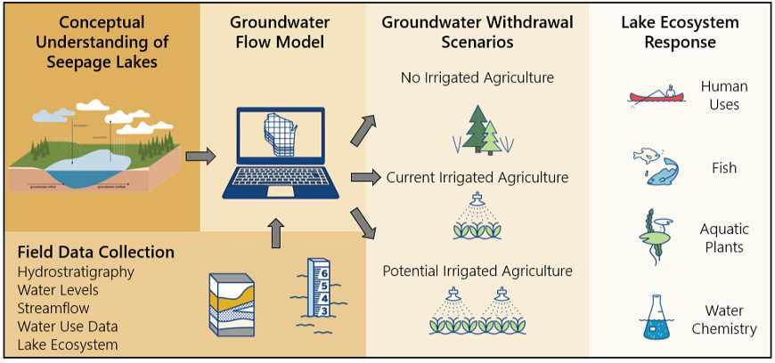
The DNR collaborated with USGS Upper Midwest Water Science Center to develop a state-of-the-art modeling approach and used an established numerical groundwater flow model to evaluate how groundwater withdrawals, land use changes and climate affect lake levels. To inform the model, we used inputs such as groundwater and surface water quantity data, hydrologic and geologic information, water use reporting and precipitation. The Central Sands Lake Study model estimated the reduction in lake levels due to groundwater withdrawals.
The study’s key findings are:
- Groundwater withdrawals cause reductions in Pleasant, Long and Plainfield Lakes. The reductions are significant and impact the lakes’ ecosystems and human use in Long and Plainfield Lakes. The reductions to Pleasant Lake are not significant; however, impacts to Pleasant Lake are near significance thresholds.
- Precipitation differences from year to year can also cause changes in lake levels and groundwater levels over time at a scale greater than just groundwater withdrawals. However, the reduction in lake levels was in addition to this precipitation signal — in other words, pumping made lake levels even lower during dry periods.
- Differences in precipitation and evapotranspiration patterns, land use, soil types and many other factors can lead to different recharge rates — even on nearby fields.
- Lake level drawdowns from any one individual well are very small, but the drawdown from dozens or hundreds of wells combined can accumulate into a significant impact.
The DNR recommends in the study report to the legislature a regional framework to manage water withdrawals, such as a water use district, to address water level impacts in the Central Sands Region.
- Study Lakes - Pleasant Lake, Long Lake and Plainfield Lake
-
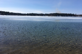
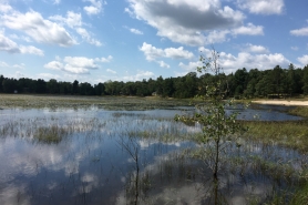
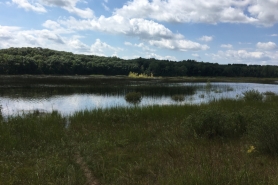
The three study lakes are Pleasant Lake, Long Lake and Plainfield Lake, located in Waushara County within the Central Sands Region. All three study lakes are seepage lakes, meaning they have no streams or rivers flowing into or out of the lakes and the primary source of water for the lakes are precipitation and groundwater inflow.
As part of the study, the DNR defined “significant reduction…of the navigable lake’s …average seasonal water levels” for these lakes (s. 281.34(7m)(b), Wis. Stats). All of the study lakes experience variability in lake levels, and the levels vary more between years than they do between months. The DNR defined average seasonal water level to mean the pattern of high, normal and low lake levels that naturally occur on the study lakes. The DNR defined significant reduction to be a deviation from this natural pattern that was large enough to cause a significant impact or change to the study lake ecosystems.
The DNR determined how changing water levels can impact human uses (recreational opportunities), fish, aquatic plants and lake chemistry and groundwater withdrawals lower lake levels across the full range of water levels (high, low and median). The DNR concluded significant reductions from current irrigated agriculture result in impacts to the ecosystems at Long Lake and Plainfield Lake. The DNR provides additional details in the Lake Resource Methodology Presentation, the Central Sands Lakes Study Report: Findings and Recommendations, Appendix B and Presentation.
Study Lakes Descriptions
Pleasant Lake Pleasant Lake is the largest of the three study lakes, with a maximum depth of 25 feet and a surface area of 120 acres. Pleasant Lake has many homes along the shoreline and is used for fishing, swimming, water skiing and boating. Pleasant Lake is mesotrophic. Mesotrophic lakes are characterized by moderate plant and algae growth and medium nutrient levels, and they are fairly clear with submergent plants. Pleasant Lake is the only one of the study lakes that stratifies — meaning the lake forms a warm upper and cold lower layer. Stratification is important for water quality and aquatic organisms. Pleasant Lake also has hard water, good water clarity and a high-quality aquatic plant community. It supports a fishery consisting of bluegill, pumpkinseed, perch, largemouth bass and northern pike, in addition to other non-game and small fishes.
Long Lake Long Lake is a 40-acre lake with maximum depths of 10-14 feet. Long Lake has many homes along the shoreline. Long Lake supports a stunted bluegill and bass fishery and is used for wildlife viewing, fishing, swimming and slow/no-wake boating. Long Lake is shallow, well-mixed and also mesotrophic. Long Lake occasionally experiences low dissolved oxygen levels, even though there are mechanical aerators in the lake to improve oxygen levels.
Plainfield Lake Plainfield Lake is a 29-acre lake with maximum depths of 11-12 feet. Plainfield Lake is within a State Natural Area and has a few homes on the shoreline. The lake is home to a rare, federally-protected plant and has high quality emergent wetlands. The lake only supports fish intermittently and is primarily used for wildlife viewing, birdwatching and waterfowl hunting. Plainfield Lake is a shallow, well-mixed, oligotrophic lake. Oligotrophic lakes are typically clear, due to the low algae, productivity and nutrient levels in the lakes. Plainfield Lake has hard water (high alkalinity, calcium and magnesium concentrations).
- Central Sands Background And Outreach Resources
-
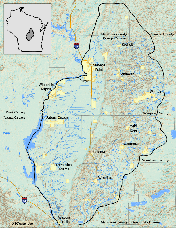
The Central Sands Region lies east of the Wisconsin River and encompasses 1.75 million acres in parts of Adams, Marathon, Marquette, Portage, Shawano, Waupaca, Waushara and Wood counties. The region is underlain by deposits of sand and gravel, with localized deposits of fine-grained sediment that were left by glaciers at the end of the last ice age. The 800 miles of trout stream and 300 lakes are generally well connected to the sand and gravel aquifer and provide recreation and tourism value including hunting, fishing, canoeing and kayaking. The productive sand and gravel aquifer also supports groundwater withdrawals from water uses such as: irrigated agriculture, public and private water supplies and commercial and industrial users.
Studies of the connection between groundwater and surface water resources have been ongoing in the Central Sands since the advent of widespread groundwater pumping in the 1960s (see additional resources below). For the Central Sands Lakes Study’s unique set of questions on impacts to the three study lakes, the DNR considered land use and water use changes over the past 150 years. The timeline illustrates the progression of land cover and use change across the Central Sands Region which began nearly a century before the start of more widespread groundwater pumping starting in the 1960s.
Resources
- Central Sands Bibliography
- Little Plover River Groundwater Model
- The connection between groundwater and surface water: Little Plover River USGS Project Video
Map Of The Central Sands
The Central Wisconsin Sand and Gravel Aquifer is defined as a contiguous area east of the Wisconsin River with sand and gravel surficial deposits greater than 50 feet deep.
- Hydrogeology Of The Central Sands
-
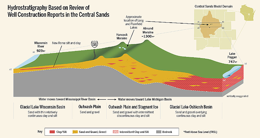
The DNR worked with the Wisconsin Geological and Natural History Survey to understand the interaction between groundwater and surface water of the three study lakes and to define the hydrostratigraphy of the groundwater system. Hydrostratigraphy divides the different sediments and rocks into distinct units based on their unique hydrologic properties and provides layers for the groundwater flow model.
The Wisconsin Geological and Natural History Survey reviewed existing literature and data relevant to the study. DNR staff helped refine locations for over 50,000 wells based on well construction reports and other sources. Staff from the Wisconsin Geological and Natural History Survey and DNR conducted field work in the Central Sands to better characterize the geology and groundwater levels for areas in and around the three study lakes.
View the report and watch these presentations: Overview Of Hydrostratigraphy and Central Sands Glacial Geology, Hydrostratigraphy And Lake-Groundwater Interactions, which detail the findings of the hydrogeologic study.
Hydrostratigraphy Report Appendices
- Appendix A
- Appendix B
- Appendix C
- Appendix D
- Appendix E
- Appendix F
- Appendix G
- Appendix H
- Appendix I
- Appendix J
Key hydrogeological findings include:
- The Central Sands Region is dominated by sand sediments but also has areas of fine-grained materials (as shown in the red areas in the schematic cross-section below).
- Water levels in all three study lakes are closely linked to the surrounding groundwater levels — as precipitation and other variables cause the water table to rise and fall, the lake levels respond.

