Southern Lake Michigan Coastal
Regional Master Plan
The department is initiating a regional master planning process for the Southern Lake Michigan Coastal Ecological Landscape which includes the majority of Milwaukee, Kenosha and Racine counties, as well as portions of Ozaukee, Washington and Waukesha counties.
The Southern Lake Michigan Coastal Ecological Landscape includes state parks, trails, natural areas, wildlife areas, fishery areas and a state forest. This landscape is the most populated of all the 16 regions with approximately 25% of the state's total population living in this region. The region encompasses over 843 square miles along Lake Michigan's shoreline. A few of the DNR properties addressed in this regional plan include the Chiwaukee Prairie-Carol Beach Natural Area, Forestry Exploration Center, Hank Aaron State Trail, Lakeshore State Park, Richard Bong Recreation Area, White River State Trail along with others.
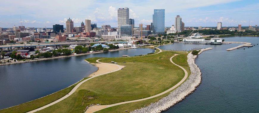
Lakeshore State Park
Planning Update
The Department of Natural Resources has initiated a regional master planning process for the Southern Lake Michigan Coastal region. To provide background, the department has prepared brief profiles of many of the properties included in this master plan along with information about the ecological, recreation and socioeconomic characteristics of the broader region within which the properties are located. The Regional and Property Analysis document, list of all properties to be planned, and property profiles for many properties included in the plan can be viewed here:
- Read the Southern Lake Michigan Coastal Regional and Property Analysis [PDF]
- List of properties to be planned in the SLMC [PDF]
- Property Profiles [PDF]
Public Input
From June 11 to July 16, 2025 the DNR held a formal scoping public input period where the public was invited to share their comments regarding the existing and future use and management of DNR properties within the region to help identify topics that should be addressed during the plan's development. A summary of the input received during the public input period is now available. The raw data and public comments received can be requested by contacting the SLMC property planner.
The department is now in the process of developing the Draft Southern Lake Michigan Coastal Regional Master. When complete, the public will have an opportunity to review the draft document and provide their comments through an additional public input period. To stay informed about the SLMC regional master plan and its development, please click the link above and sign up to receive updates.
Additional comments and questions regarding this regional planning process may be submitted to:
Dominique Swangstu, DNR Property Planner
Dominique.Swangstu@wisconsin.gov
920-492-8822
The map below shows the location of many of the properties in this planning process.
Click the map below to read about the properties and management considerations for each. If the map is not loading, be sure your pop-up blocker is turned off.
Access a full-screen version of the Interactive Map of Southern Lake Michigan Coastal Regional Master Plan Properties.
Ecological Characteristics and Management Opportunities
The Southern Lake Michigan Coastal Landscape encompasses 843 square miles, which is 1.5% of the area of Wisconsin. The region is located in the southeastern corner of Wisconsin along Lake Michigan and the Illinois border. The region contains the majority of Milwaukee, Kenosha and Racine counties as well as portions of Ozaukee, Washington and Waukesha counties. The landscape and different landforms within the region are characteristic of those typical along Lake Michigan, generally associated with and produced by past glacial lakes. These landforms include lake dunes and beaches, ridge-and-swale topography, wave cut clay bluffs and level lake plains. Further inland to the west, gently undulating ground moraine is the dominant landform.
The region is heavily dominated by urban, industrial and agricultural land uses, leaving small fragmented natural areas. Only just over 1% of the land area within this region is in public ownership (WDNR, 2015a). Most natural community remnants are small, isolated and often degraded, occurring within a context of lands that are now generally dedicated to supporting residential, industrial and agricultural uses. Despite all the development that has occurred in the area, this ecological landscape supports rare and declining species and communities that occur in few other locations in the state.
Lake Michigan is the overwhelming aquatic feature of the region, it impacts the climate, recreation and the economy. The climate is moderated by the region's proximity to the lake, leading to warmer temperatures in the fall and early winter, slightly cooler temperatures during spring and early summer and onshore winds bringing cooling effects in the spring and summer. The mean growing season is 169 days, and mean annual temperature is 47.2°, the longest and warmest of any ecological region in the state. Despite the heavy urbanization of the region, agriculture, specifically row crops, small grains and pastures, are prevalent land uses in the non-urbanized parts of the region. Throughout human habitation of the area, Lake Michigan has also provided important access to food through its fisheries, which became a robust commercial and sport fishery in the mid-19th century. Since then, non-native species such as sea lamprey, rainbow smelt and alewife have negatively impacted the fishery. Whereas, the introduction of other nonnative fish, including coho and chinook salmon, has revitalized the sport fishery in the region.
Historically, the region developed as a transportation hub utilizing Lake Michigan as a major harbor. The legacy of that usage is still seen today in the region's urbanization, population density and transportation infrastructure. Road density within the region is over three times higher than the state as a whole. The region has six airports, including the largest airport in the state, Mitchell International, which handles 66% of all passenger flights in the state (WDNR, 2015a).
Lake Michigan's aquatic attributes and shoreline features are essential to supporting a wide range of water-dependent or water associated species. Recently, Lake Michigan has experienced an increase in the abundance of native green algae and non-native aquatic invasive species, resulting in a number of water quality, public health and recreation related issues. There are also a large number of impoundments in the region, where many streams have been dammed for a variety of economic and recreational purposes. There are 5,811 acres of shallow impoundments behind 54 dams in the region. These dams create marshlands that now provide habitat for a variety of wildlife species, especially birds, which may have relatively little suitable nesting or foraging habitat elsewhere in the region.
Large forests are relatively rare in the region, however there is a regional emphasis on urban forestry, in part due to the large proportion of suburban areas associated with the cities of Milwaukee, Racine and Kenosha. Wetlands are uncommon, making up only 8.5% of the region's vegetation. Forested wetlands are the most abundant wetland type. Coastal Prairies, fens and associated wetlands along and near Lake Michigan in southeastern Kenosha County are of special interest because of their global rarity and generally good condition. Floristic diversity of this coastal area is exceptional. The area, known as Chiwaukee Prairie, also supports many rare animals.
The Southern Lake Michigan Coastal region is the most densely populated and intensively developed ecological landscape in the state. Nearly a quarter of the people in Wisconsin live in this region and over 20% of the state's jobs are located here. The three counties covering the majority of this region, Kenosha, Milwaukee and Racine, are dominated by three urban areas of the same names, with the City of Milwaukee alone holding one tenth of the state's population (USCB, 2020a).
The Southern Lake Michigan Coastal EL offers the following important ecological opportunities:
- Lake Michigan Shoreline, Shoreline Habitats and Nearshore Waters
- Great Lakes Coastal Prairies and Wetlands
- Oak Opening and Oak Woodland
- Rivers, Streams and Riparian Corridors
- Inland Lakes and Impoundments
- Surrogate Grasslands
Recreation Resources and Opportunities
The urban influence of Milwaukee and its surrounding suburbs has created an additional demand for distinctly urban recreation facilities such as dog parks, city trails, sports fields and basketball courts. Although the SLMC is heavily influenced by urban and suburban characteristics as well as its dense population, there is a large demand for nature based outdoor recreational activities and facilities. The region is scattered with local, county, state and private recreational facilities which tailor to residents and visitors. Lake Michigan itself is a major recreational resource, providing opportunities for fishing, swimming, windsurfing, sailing and all types of boating. There are a number of parks and public spaces located along the lake, including county and municipal parks in addition DNR lands such as Lakeshore State Park and Chiwaukee Prairie-Carol Beach State Natural Area.
Several rivers drain into the Lake Michigan through this region including the Milwaukee, Menomonee, Root and Pike Rivers. These waterways provide good fishing opportunities that include spring and fall runs of salmon and steelhead from Lake Michigan. Multi-use trails in the region provide opportunities for walking, bicycling and rollerblading. Since the area is heavily urbanized, opportunities for hunting are limited, though there are many fragmented patches of natural landscapes and green spaces that provide opportunity for bird watching and nature observation.
Although the region is smaller and more urbanized than others in the state, many DNR properties within the SLMC offer unique recreational opportunities. The Richard Bong State Recreation Area, located between Burlington and Kenosha, is considered to offer the widest variety of recreation activities of any state property, including canoe/kayaking, swimming, fishing, picnicking, camping, horseback riding, cross-country skiing, snowmobiling, ATV and off-road motorcycling, model plane/rocket testing, and hunting.
Socioeconomic and Cultural Context
Socioeconomic and cultural context is important in understanding the needs of the public when planning the properties in the SLMC ecological landscape. Due to the method by which economic and cultural data is collected and made available, the context within the Regional and Property Analysis is generally associated with the entirety of the counties substantially intersected by the Southern Lake Michigan Coastal Ecological Landscape, rather than for the landscape itself. Those counties are Kenosha, Milwaukee and Racine. Other counties that intersect with the region include Ozaukee, Washington and Waukesha Counties, which were not included in much of the analysis because less than 25% of each of these counties overlap the SLMC region. Ten of the 20 most populated cities in the State of Wisconsin are within the Southern Lake Michigan Coastal EL, some of which are not identified within this section based on how the data was collected. Therefore, there inherently is some variability in populations, densities, and other statistics within this analysis compared to the actual data for the ecological landscape as a whole.
Public involvement
DNR will be holding a scoping public input period for the properties included in the Southern Lake Michigan Coastal Regional Master Plan in summer 2025. During this public input period residents can provided feedback related to existing facilities as well as identify opportunities and challenges associated with the DNR lands within the region. The public will be invited to an in-person meeting (presentation and open house) on June 23, 2025 to share their thoughts on the opportunities, challenges, topics and general condition of the DNR properties included in this planning process. If additional demand warrants, a second in-person meeting will be held during this phase of the planning process to gather additional public input on the properties included in the plan.
In addition to the public meeting(s), the public will have the opportunity to submit feedback through surveys associated with the SLMC region and its properties. The surveys will be available in person (during the public meeting) or online during the public input period. Although the department accepts comments and feedback regarding its properties anytime, this public input period is the primary means to submit public comments regarding the creation of the SLMC regional master plan.
Maps
Additional Planning Resources
- SLMC Regional and Property Analysis [PDF]
- List of properties to be planned (SLMC) [PDF]
- SLMC Property Profile Pages [PDF]
- Chapter 19: Southern Lake Michigan Coastal Ecological Landscape [PDF]
- Rapid Ecological Assessment for the Wildlife and State Natural Areas of the Southern Kettle Moraine Region [PDF]
- Rapid Ecological Assessment for the Southern Lake Michigan Coastal Ecological Landscape [PDF]
- Recreation Opportunities Analysis [PDF]
- Wisconsin Statewide Comprehensive Outdoor Recreation Plan [PDF]