Drought Status and Management
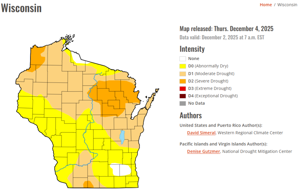
The State of Wisconsin has not declared a drought emergency.
Current Drought Conditions
The map above is updated monthly. For additional data, visit the U.S. Drought Monitor website.
Drought Intensity Definitions
Abnormally dry - Going into drought there is short-term dryness slowing planting and growth of crops or pastures. Coming out of drought there may be some lingering water deficits, while pastures or crops have not fully recovered.
Moderate drought - Some damage to crops and pastures. Streams, reservoirs, or wells may be low, with some water shortages developing or imminent. Voluntary water-use restrictions are requested.
Severe drought - Crop or pasture losses are likely. Water shortages are common and water restrictions are imposed.
Extreme drought - Major crop and pasture losses. There are also widespread water shortages or restrictions.
Exceptional drought - There are exceptional and widespread crop and pasture losses. There are water shortages creating water emergencies.
Types of Drought
A listing of drought types is available on the Ready Wisconsin website.
Wisconsin Drought Management
Wisconsin has experienced drought to varying degrees with the most notable droughts occurring in 1988 and 2012. Depending on the severity, drought may impact water use in agriculture, public water supply, hydropower and transportation on major rivers.
Wisconsin’s Emergency Management Response Plan includes Wisconsin’s Drought Response Plan. The plan describes the agencies involved and the coordinated response to all issues surrounding drought including water availability, fires and crop loss.
In response to Wisconsin’s 2012 drought, three Executive Orders were issued:
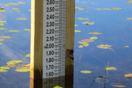
Monitoring Water Levels
Streamflow and groundwater levels provide a good indicator of environmental response to drought. The USGS streamflow gage across the state shows where the parts of the state experiencing low flow.
The DNR and its partners at the United States Geological Survey (USGS) and the Wisconsin Geological and Natural History Survey (WGNHS) collectively operate and maintain a statewide network of monitoring wells that provide necessary long-term data. Department staff track recent and historical precipitation and compare that data to long-term averages to characterize and identify trends. Learn about the groundwater levels and access the DNR’s water quantity data viewer.
Other Resources
- Department of Health Services Drought Toolkit
- Air Quality Interactive Map
- The University of Nebraska provides updated resources on Wisconsin and nationwide drought conditions: Conditions & Outlooks | U.S. Drought Monitor (unl.edu) with additional detail about Wisconsin at https://www.drought.gov/states/wisconsin. This website also includes historical impacts of drought that Wisconsin has experienced.
- USDA has current maps on drought and how it affecting crops: AgInDrought.pdf (usda.gov)
- Comparing droughts through the years: Historical Data and Conditions | Drought.gov
- For buying or selling forage visit: Farmer to Farmer - University of Wisconsin-Extension. DNR assumes no responsibility in the transaction of buying or selling the items listed on this website. All transactions and negotiations are handled directly between buyers and sellers.


