Black River team
Streambank Protection Program
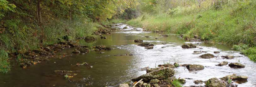
The Black River Region represents the heart of brook trout country in the Driftless Area. This region holds some of the best natural habitats and the lowest land use stress for brook trout populations. This high level of habitat potential is reflected in the region’s fishery ‐ these sub‐watersheds are dominated by brook trout. A majority of sub‐watersheds here rank well for brook trout because of the heavy forest cover, a relatively limited amount of cattle, and a low population density which limits the number of impervious surfaces. The region is characterized by a few large population centers and it is no coincidence that anthropogenic stress is less in the eastern part of the region because this is where most of the public land holdings occur.
In the Black River Region, the majority of angling effort is local and pressure is light to moderate. There are several possible reasons for these characterizations. First, the area has an overall low population density and few large population centers. Most of the public lands allowing ample access to trout streams are located in a very small part of the region in the far northeast in Trempealeau and Jackson Counties.
Considerations
- The Black River Region along with its northern neighbors, the Kinnickinnic and Chippewa river regions, represent the heart of brook trout country in the Driftless Area. This region holds some of the best natural habitats and the lowest land use stress for brook trout populations.
- Trout streams in the Black River Region are projected to be more resilient to the effects of global warming on brook trout, compared to all the planning regions in the Driftless Area. In fact, the Black River Region could act as a core “reserve” area for brook trout in the future.
- The Fleming Creek Watershed holds the most stream miles in the entire Driftless Area projected to be “stable” (40.8 miles) for brook trout. The contiguous Fleming Creek, Beaver Creek, and the Upper Trempealeau River watersheds, will likely be critical in the future management of brook trout in Wisconsin.
- Streams of the Black River Region have experienced the little establishment of brown trout, which is beneficial to the existing brook trout population.
- Public access for trout fishing is excellent in the northeast (Halls Creek and Harvey/Buffalo watersheds) and southeast parts of the region (Fleming Creek watershed). Trout angling access is low-to-poor in most other areas. Public access is among the lowest of all the planning regions.
- Relatively good access exists in sub-watersheds where the best smallmouth bass populations are present. However, there is a gap in public access in the lower Black River - Fleming Creek sub-watershed.
Highlighted streams
- Timber Creek
- Beaver Creek
- Pigeon Creek
- Stony Creek
- Tank Creek
- Lowe Creek
- Trempealeau River
- North Fork Beaver Creek
- Dutch Creek
- Washington Cooley Creek
Partners
- TU – Coulee Chapter
- Driftless Area Land Conservancy
- North Central WI Land Conservation Departments
- Natural Resources Conservation Service
- Arcadia Rod & Gun Club
- Alma Rod & Gun Club
- Durand Rod & Gun Club
Accomplishments
The Black River Team and its conservation partners have worked to acquire stream bank easements directly from landowners within their region. These easements provide public access to high-quality trout streams and allow the DNR to manage these stream corridors to increase the health of the trout fishery for today and future generations.
From July 2014 to June 15, 2016, the Black River Team worked with property owners to purchase 2 easements in 1 subwatershed. These transactions resulted in a total of 4.73 easement acres encompassing 1,796 stream feet (0.34 miles) at a cost of $16,200; an average of $3,425 per easement acre or $9.02 per stream foot.