Butler Lake Flynn's Spring
No. 257
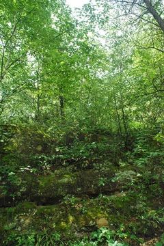
Photo by Deb Harder
Butler Lake and Flynn's Spring features a seven-acre shallow hard-bottom lake surrounded by a sedge meadow. Previously, the site contained a tamarack hardwood swamp but a few years of high water levels have killed off most of the trees. Although the ground layer has also been flooded, the aquatic vegetation and geologic features are still intact. Nearby Flynn's Spring is a small, spring brook flowing into the south end of Butler Lake.
Chara covers the marl-bottomed Butler Lake while the dominant submerged aquatic species is Illinois pondweed. Emergents include white water lily, bull-head pond lily, and hard-stem bulrush. A small zone of sedges and bulrushes on the north end is the only open wetland. Older tamaracks, which formerly surrounded the lake, have died but the species is reproducing well along the northwestern and southern shores.
Adjacent to the lake is Parnell Esker, a geologic feature known worldwide and used extensively for education. The esker is 5 to 35 feet in height and runs northeast-southwest for about four miles. The lake and wetlands provide a habitat for some uncommon invertebrates. Butler Lake and Flynn's Spring is owned by the DNR and was designated in 1992.
Very few State Natural Areas have public facilities, but nearly all are open for a variety of recreational activities as indicated below. Generally, there are no picnic areas, restrooms, or other developments. Parking lots or designated parking areas are noted on individual SNA pages and maps. Trails, if present, are typically undesignated footpaths. If a developed trail is present, it will normally be noted on the SNA map located under the Map tab. A compass and topographic map or a GPS unit are useful tools for exploring larger, isolated SNAs.
The good majority of SNAs are isolated and have few or no facilities. Some SNAs have vehicle access lanes or parking lots, but their accessibility may vary depending on weather conditions. Parking lots and lanes are not plowed during winter. Hiking trails may be nonexistent or consist of undeveloped footpaths. A GPS unit or compass and a detailed topographic map are useful tools for exploring larger SNAs.
Entrance fees: Except for Parfrey's Glen, the Cambrian Outlook in the Dells of the Wisconsin River, SNAs within State Parks and some within State Forests, all other DNR-owned SNAs do not have any admission fees. For more information, see Wis. Admin. Code NR 45. For non-DNR-owned SNAs, we are unaware of any vehicle or admission fees. However, please contact the landowner for more information.
NOTE: Per state regulations, hunting is allowed on the DNR-owned SNA lands. However, on lands located within the Village of Rock Springs (see map), the discharge of firearms is prohibited within the village limits. See their Village Ordinance Chapter 4 [exit DNR] for details.
ALLOWABLE ACTIVITIES: DNR-OWNED LAND
The activities listed below are generally allowed on all DNR-owned SNA lands. Exceptions to this list of public uses, such as SNAs closed to hunting, are noted above and posted with signs on the property site.
- Hiking
- Fishing
- Cross country skiing
- Hunting
- Trapping
- Scientific research (permit required)
- Outdoor education
- Wild edibles (What is this?)
- Pets (Rules)
- Wildlife viewing
PROHIBITED ACTIVITIES: ALL SNAS
- Camping and campfires
- Collecting of animals (other than legally harvested species), non-edible fungi, rocks, minerals, fossils, archaeological artifacts, soil, downed wood, or any other natural material, alive or dead.
- Collecting for scientific research requires a permit issued by the DNR
- Collecting of plants including seeds, roots or other non-edible parts of herbaceous plants such as wildflowers or grasses
- Geocaching
- Horseback riding
- Rock climbing
- Vehicles, including bicycles, ATVs, aircraft, and snowmobiles except on trails and roadways designated for their use.
For rules governing state-owned SNAs and other state lands, please consult Chapter NR 45 Wis. Admin. Code [exit DNR].
Location
Within the Northern Unit of the Kettle Moraine State Forest, Sheboygan County. T14N-R20E, Section 20. 163 acres.
Driving directions
From the intersection of State Highway 67 and County Highway F in Dundee, go east on F for one mile, then north on Division Road for 1 mile, then east on Butler Lake Road for 1.1 miles, then south on an access road 0.1 miles to a parking area, boat launch, and trailhead for the Butler Lake Trail. The wetlands are best accessed by canoe.
The DNR's state natural areas program is comprised of lands owned by the state, private conservation organizations, municipalities, other governmental agencies, educational institutions and private individuals. While the majority of SNAs are open to the public, access may vary according to individual ownership policies. Public use restrictions may apply due to public safety, or to protect endangered or threatened species or unique natural features. Lands may be temporarily closed due to specific management activities.
Users are encouraged to contact the landowner for more specific details. The data shown on these maps have been obtained from various sources, and are of varying age, reliability, and resolution. The data may contain errors or omissions and should not be interpreted as a legal representation of legal ownership boundaries. To create your custom map where you can zoom to a specific location, please use the DNR's Mapping Application.
Butler Lake Flynn's Spring is owned by: Wisconsin DNR