Snapshot Wisconsin May 2021
This edition of the Snapshot Wisconsin newsletter focuses on research aimed at taking the program to the next level, as well as highlighting an unusual volunteer and the nature center where she works.
Snapshot And Satellites: A Creative Pairing
The Snapshot team shares some interesting research by a departing graduate student on pairing ground monitoring using trail cameras with satellite images from space.
Volunteer Highlight – River Bend Nature Center in Racine County
Christa Trushinsky from the River Bend Nature Center in Racine County discusses how she incorporates photos from her trail camera into the programming at the nature center. She also describes how Snapshot has helped deepen her understanding of how the nature center’s forest changes throughout the year.

SNAPSHOT AND SATELLITES: A CREATIVE PAIRING
A few months ago, the Snapshot team said farewell to someone who has worked with the Snapshot Wisconsin team for several years. John Clare, a former graduate student at the University of Wisconsin-Madison, completed his PhD in December, 2020 and has moved on to a post-doctoral position at the University of California-Berkley.
While completing his doctoral degree, Clare worked in Drs. Ben Zuckerberg and Phil Townsend’s labs, and his research has helped push Snapshot Wisconsin to the next level, expanding the capabilities and reach of Snapshot Wisconsin. Although he played a behind-the-scenes role, one of a few students studying how to use Snapshot data in new and useful ways, his contributions to the team are appreciated, so the Snapshot team decided to share a piece of his research with those of you who follow this newsletter.
Clare first connected with Snapshot Wisconsin when current Snapshot team leader, Jen Stenglein, got in touch. Stenglein, Quantitative Research Scientist at the DNR and a leading member on the data analysis side of Snapshot Wisconsin, was interested in the sampling parameters of Clare’s Masters research, which also dealt with trail cameras. Stenglein hoped to learn from that project and apply lessons to Snapshot Wisconsin.
“I didn’t know about Snapshot Wisconsin until after talking with [Stenglein],” said Clare. “I later saw a posting for a PhD assistantship related to the program, and I applied. That is how I first got involved.”

Clare was one of the first graduate students working with the project. He initially helped get the program up, and later he started to sort through the data and deliver some useful results.
While we don’t have the space to cover everything he worked on for his dissertation, Clare and the Snapshot team wanted to share a small piece of Clare’s research with the volunteer community and showcase part of how Clare contributed to the project.
LEVERAGING SNAPSHOT DATA
A central goal of Clare’s dissertation was to develop strategies to better leverage the spatial and temporal capabilities of the Snapshot database. Clare mentioned that two unique features of Snapshot Wisconsin are that Snapshot operates both statewide and year-round. Many other monitoring programs can’t operate at such wide and long scales because it would be too resource intensive for them. Fortunately, Snapshot has the help of thousands of people across Wisconsin (and the globe) to overcome that resource barrier and operate statewide and year-round.
“[Using data from all over the state and from all times of the year], we can explore questions in ways we didn’t have the ability to before,” said Clare, and Clare investigated a few of these questions in his dissertation. Two of Clare’s research questions were what broad factors drive where species are distributed and how species are active across the year.
To answer both questions, Clare needed to build a special type of model that leveraged both spatial and temporal data at the same time. Not an easy feat.
SETTING UP CLARE’S MODEL
Clare needed a unique model that could account for how species are spatially distributed around the state and temporally distributed throughout the year. “I think it’s important to take advantage of both the spatial and temporal components at the same time,” said Clare. “The question isn’t just where are species located, but also how species are distributed at time x, time y and time z.”
Both the spatial and temporal scales were needed because there are components of the environment that vary strongly across space and time. Snow depth, for example, is not fixed over the course of the year. One week, there may be six inches, and the next week there may be twelve. Snow depth also varies spatially. A few miles could be the difference between seeing snow on the ground or not. Many environmental factors are highly dynamic and variable like this, so Clare needed to think of these factors within a model that accounts for both.
It is common for models to use one type of data but incorporating both is a challenge. The main challenge is having enough data (and data of the right types) to run this kind of analysis. Fortunately, Snapshot images have both location and time data attached to each image.
Another unique aspect of Clare’s model is that it considers multiple species at once. “We were pretty sure that individual species are distributed dynamically throughout space and time, but entire communities have not been heavily studied in the same way,” Clare said. “The appeal of using a spatial-temporal structure across the entire community is that we can explore which species are interacting with others at different parts of the state and at different times of the year.”
This concept isn’t new to the realm of modeling, but it is hard to accomplish. Researchers would need separate data for each additional species they added in the model. It can be hard enough getting data for one species, let alone multiple. However, that is where Snapshot shines best. Volunteers can tag up to 50 unique species in their Snapshot photos, so an equal number of species-specific datasets can be pulled and created from the larger Snapshot dataset.
“The advantage of a multispecies approach is that you can take into account the responses of each of those species, as opposed to modeling one species and assuming the results apply uniformly for other species,” said Clare.
DRIVING DISTRIBUTION AND ACTIVITY
Knowing he had the ability to answer his questions, Clare thought about which factors might be most influential across the entire community, in terms of predicting where species were located and how active they are. “We had a couple ideas about what these factors might be,” said Clare. “Some were related to seasonal variation like the amount of snow and the greenness of the vegetation.”
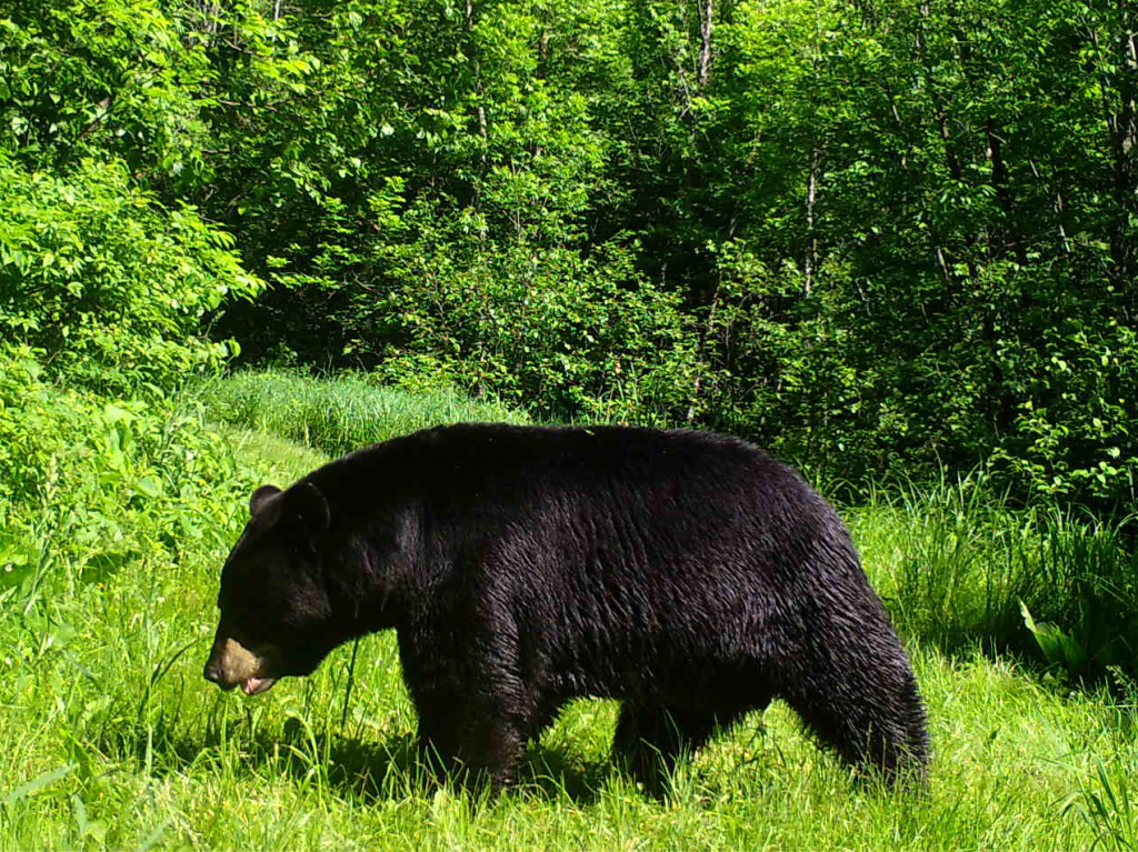
Snow depth can change substantially from day to day, even during the winter. Snow depth could dramatically impact how species move around and where food is available. Snow can even correlate to which species are even seen during parts of the year. For example, black bear behavior is often related to the winter, and thus with snow.
Wisconsin’s black bears sleep through the winter. Since winter is also associated with snow, black bear activity inversely correlates well (in Clare’s model) with snow. When there’s more snow on the ground, we are (most likely) deep into winter and see the least activity from black bears.
Another environmental variable that Clare was interested in was vegetative greenness. Vegetative greenness is, from space, how green the landscape looks. In the spring, trees will start to bud burst, and the grass will grow. The landscape itself will just be greener than the previous months, and more nutritional energy will flood into the food web. Vegetative greenness varies throughout the year and can impact how animals use the land, depending on when and where food is available.
For example, a black bear’s seasonal activity could reflect the cycle of vegetative greenness. Black bears maximize their activity at times of the year when there are more food resources around, either plants or prey. These times of the year may strongly correlate to peak greenness of the landscape, or so Clare theorized.
But you might be thinking, “Wait, can the Snapshot cameras measure vegetative greenness and snow depth from the trail camera photos?” The answer is possible, but more research is needed before we can use the cameras that way. Instead, Clare used daily satellite images of the state to calculate vegetative greenness and snow depth.
LINKING SATELLITES WITH SNAPSHOT WISCONSIN
Clare used satellite images from NASA to measure snow depth and vegetative greenness. Part of Clare’s assistantship position was funded by a NASA grant whose purpose was to figure out ways to integrate a continuous stream of animal observations with a continuous stream of Earth observations coming from space. Between the trail camera data and the satellite data, Clare aimed to find connections that were meaningful to wildlife management.
Consider winter severity in deer population modeling, for example. Winter severity is already used by the DNR to predict the impact of winter on deer populations and plays a partial role in making harvest decisions for the subsequent fall. One hope of the NASA collaboration was to develop more integrated measures like winter severity for deer overwintering, especially ones that impact multiple species in similar ways.
Using the images from satellites passing over the state, Clare derived data on land use, surface temperature, vegetative greenness and snow depth. All of these variables were tested across spatial and temporal scales for all classifiable species.
CONFIRMATION AND SURPRISE
Clare wanted to share two results from his dissertation with the Snapshot community. One of these results was a confirmation of what he expected, but the other was surprising and took longer for him to wrap his head around.
“I wasn’t surprised that snow depth was a major negative driver of species activity,” Clare said. “We expected that because snow provides a refuge for some species [and a signal for other behavioral changes like hibernation].” These behavior changes cause sightings of these species to drop off during the winter and strengthens the negative correlation between snow depth and species activity. Snow is also associated with winter, when species tend to be less active to conserve energy resources.
What was more surprising was that the peak period of species activity was not associated with the peak of the growing season, or when the land was at its greenest. Clare expected these two peaks to match because there would be a maximum amount of food on the landscape. However, after some rethinking, Clare came up with a new theory about why peak activity wasn’t at peak greenness. “What we [now] think is happening is that animals don’t have to move around as much during the peak of the growing season. They don’t have to go as far to find food. It is all in one
aisle,” Clare said.
As for linking satellite data with wildlife data, snow depth and vegetative greenness both were the best predictors of species distribution and activity out of the environmental variables Clare tested. Even though vegetative greenness didn’t function how he predicted it would, it still was a good predictor of community activity and distribution. Both of these variables showed promise as potential satellite-based metrics that NASA and the DNR can use to better predict how the environment is impacting the greater wildlife community.
WHAT’S NEXT?
Now that Snapshot Wisconsin has a few years of data across most of the state, Snapshot will start looking into broader trends like year-to-year weather variation and how species habitat associations may vary from year-to-year.
“As we anticipate global changes, including more extreme events like polar vortexes, heavy rain and droughts, there is a need to understand how species react to different weather phenomenon. By looking at how species are distributed at finer time scales, we can start to address those types of questions. That wasn’t the exact focus of my research, but my research can help us start to quantify what [counts] as an extreme event for different species,” explained Clare. However, that work will be done by someone else, since Clare has graduated and moved to California.
Clare took a moment to reflect on his years working with Snapshot Wisconsin. Clare said, “My favorite part has been seeing the broader project move from a concept to an operating system. It has been really exciting to see that dream come to fruition. Most of that credit is due to the folks on the Snapshot team like Jen Stenglein and Christine Anhalt-Depies.”
Clare was also appreciative of the community of volunteers that sustain Snapshot Wisconsin. “It has been rewarding to see so many Wisconsin residents get involved,” said Clare. “I’ve been blown away with how smoothly and effectively it all has worked.”
With Clare moving on to the next step of his career, the Snapshot team wishes him the best and thanks him for helping the program get set up and running, as well as his contributions on the research side of Snapshot.
Thanks John Clare, and good luck!

VOLUNTEER HIGHLIGHT – RIVER BEND NATURE CENTER IN RACINE
COUNTY
Snapshot Wisconsin volunteers have been asking to hear about unique ways others engage with the program. Today, the Snapshot Wisconsin team highlights, not an individual, but a group that manages one of the longer-running Snapshot trail cameras – River Bend Nature Center (RBNC) in Racine County.
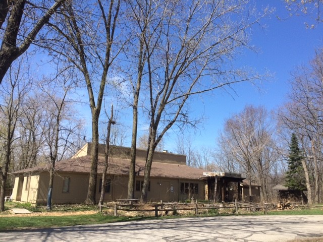
RBNC is an outdoor environmental education center that leases and manages about 80 acres of upland and lowland forest, as well as a six-acre prairie, from the county. River Bend’s primary mission is environmental education, conservation and sustainability with a variety of programs for all ages, ranging from little tikes to seniors.
Christa Trushinsky, Naturalist and Director of Education at RBNC, has worked at the nature center since 2016 and oversees their Snapshot trail camera. “I went to grad school for Environmental Conservation, so I’m very interested in exactly what Snapshot Wisconsin does, looking at the dynamics of land and the species that use it,” said Trushinsky. Trushinsky first heard about the program from a Snapshot Wisconsin team member she went to graduate school with and got in touch with her to learn more.
Little did Trushinsky know, that connection would later play a role in developing many of the nature center’s programs.
A GOOD FIT FOR RIVER BEND NATURE CENTER
River Bend has been hosting a trail camera for four years now and has found some intriguing ways to incorporate Snapshot photos into their teaching. “Snapshot Wisconsin is such a crucial tool for what we are trying to do here, especially for species that are elusive or nocturnal,” said Trushinsky.
Trushinsky said they often use Snapshot photos in their Skulls, Skins, and Scat program to help kids identify species that they wouldn’t normally be able to see. “Since some animals are nocturnal or very elusive, we can use the images to prove that these animals are out there [in the forest] and using the landscape,” explained Trushinsky. “Seeing proof of these animals in the neighboring forest makes them real to the kids in a special way. The animals are more than
something they see on TV – they are real and nearby.”
The trail camera pictures also act as a segue to the hands-on portion of the program, where participants look for animals and signs of animals (e.g. nests, burrows and tracks). “If we find an animal that can be handled, we talk to the kids about how to do so gently and appropriately,” said Trushinsky. Sometimes the children interact with an animal for the first time, such as feeling a slug’s sliminess or a snake’s scaliness. “That’s all part of it, showing them how to handle wildlife appropriately, as well as which to respect and stay away from.”
RBNC incorporates Snapshot pictures in other ways as well. Staff have introduced the concept of predator-prey relationships to children by showing time-lapse photos of predators tracking their prey. Trushinsky recalled an example of a doe walking by the camera, and a minute later, a coyote followed closely behind. Trushinsky uses Snapshot photos to start discussions about different relationship dynamics between the species seen on the camera.
Trushinsky has also taken Snapshot images off-site and given presentations at schools and colleges. To highlight examples of camouflage, she shows participants sets of pictures from the trail camera and asks them if they can figure out where the animal is and identify it. “Basically, I introduce it as, ‘Hey, this is Snapshot Wisconsin. You guys could be doing this on your property!’ I talk about what [species] we see at River Bend and take them through the process of classifying photos. Kids especially seem to get a kick out of it,” said Trushinsky.
LEARNING LESSONS THEMSELVES
While most of what RBNC does is focused on educating others, they have also learned more about he land they manage by hosting a Snapshot trail camera. Their trail camera has confirmed which species inhabit their land, as well as how the species use the land at different times of the year.
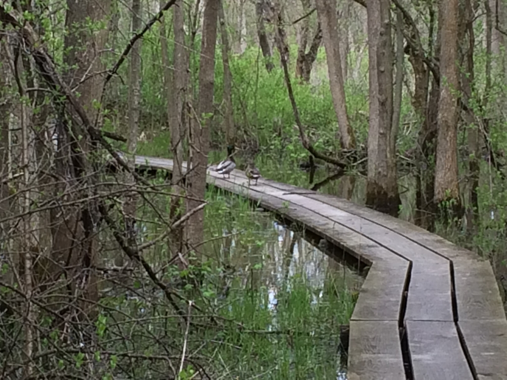
The RBNC trail camera is in a unique location, tucked away in a floodplain area of the lowland forest. During the spring season, the Root River surges, spilling over into a nearby pond, flooding the lowland forest. The flooding dramatically changes the landscape around the camera. Herons, wood ducks, mallards, and other birds can be found wading and swimming in the forest around the camera. Since RBNC’s camera looks out over the flooded area, they capture some great images that have excited birders who visit the nature center. “These are species you typically don’t see using a forest habitat. You might also see swimming muskrats or mink [while the area is still covered in water],” added Trushinsky. “It’s offered a great place to raise early season ducklings — with lots of cover.”
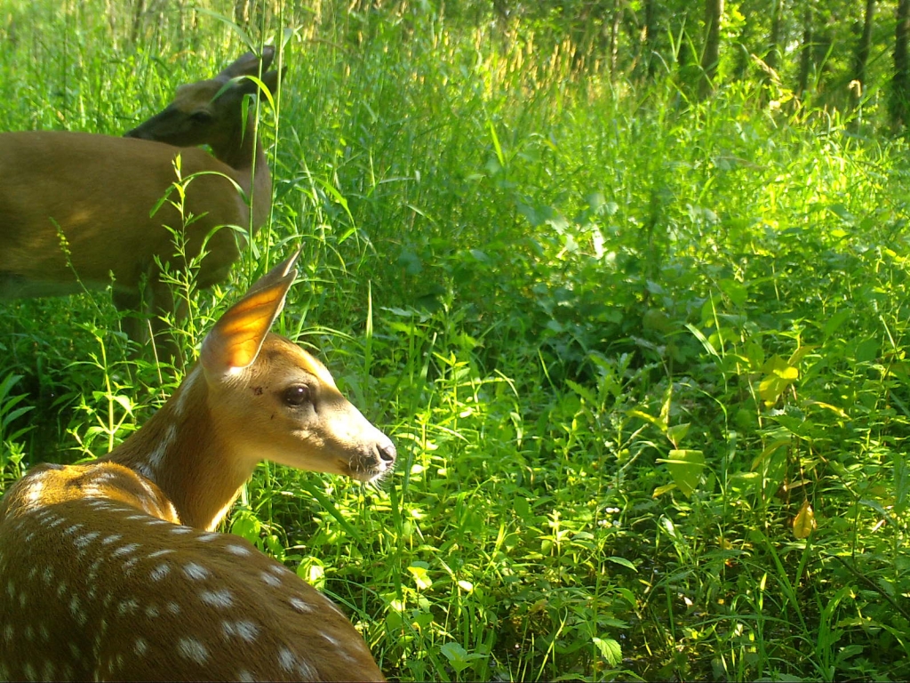
As the season shifts towards summer, the water drains, and a new batch of animals begins to use the area. Tall grass soon fills everything the camera sees, and species like deer move in. Does raise their fawns in the tall grass, and other little land creatures start to emerge.
Trushinsky said the trail camera pictures tell such a different story every season, with different animals showing up and using the land in their own unique ways. “The Snapshot camera helps us see what species are out there and if there are any novel or threatened species we need to be aware of. The presence of these species may even impact our land use plans,” said Trushinsky.
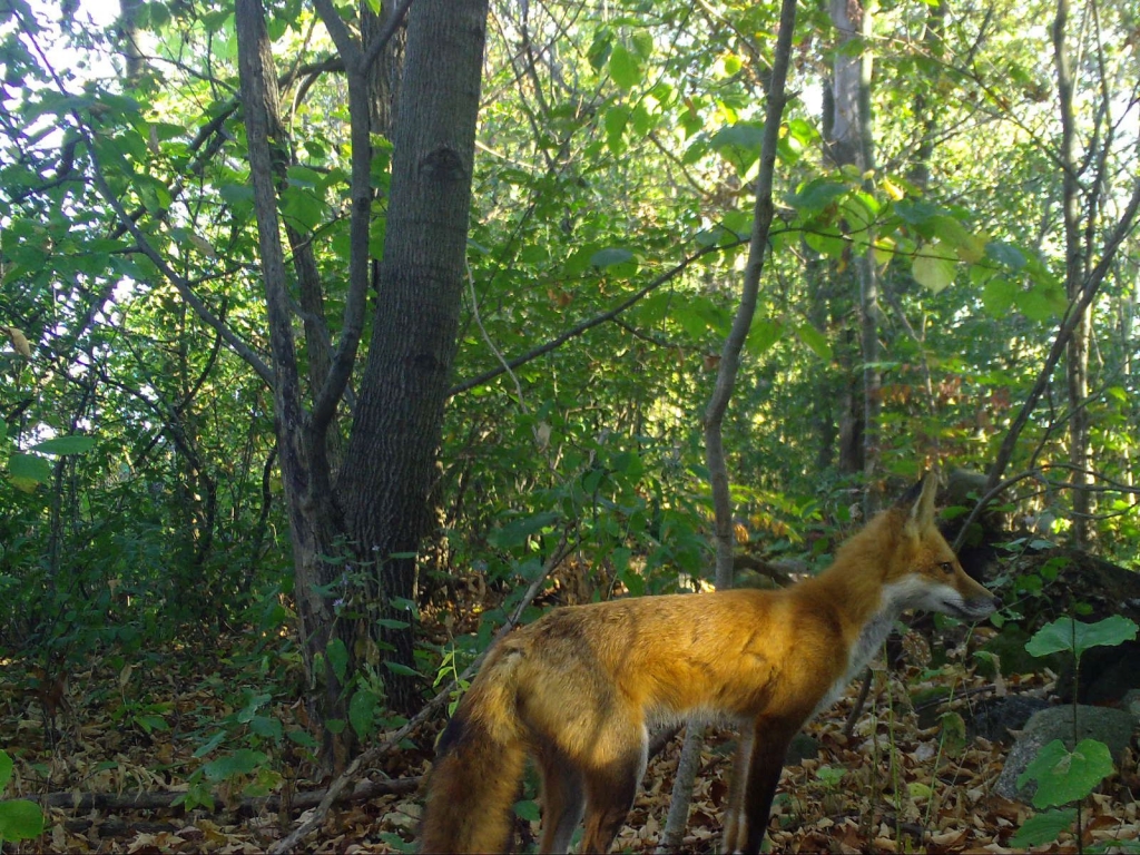
To date, RBNC’s camera has seen deer, opossums, raccoons, mink, muskrats, coyotes, mallards and great blue herons at this single camera location, just to name a few. They have also been able to identify certain butterfly and bird species (like the golden warbler) from the images, even though Snapshot doesn’t currently classify these species. The RBNC staff are hoping to see a river otter this year, but they haven’t seen one at this location yet.
Trushinsky shared her thoughts on joining Snapshot Wisconsin and the center’s unique camera location. Check out the video to hear her describe the camera in her own words.
ADVICE FOR OTHERS
Trushinsky had some parting advice for other nature centers and groups who are considering hosting a Snapshot trail camera. “Snapshot is something very easy to get into and do. There isn’t that much of a time commitment needed. You can leave the camera out there and check it every three months. The biggest time commitment is just getting to the camera and classifying the photos.”
Trushinsky also shared some of the little tricks that she has discovered over the years.
- Make sure the camera is in a place where you already see signs of wildlife. You won’t capture many photos of animals if wildlife aren’t using that area.
- Put the camera in a location that is harder for people to get to, especially if you have people who visit your land. Whenever you go out there, you leave a scent, which can impact how animals use the area. It’s good to use the same route to the camera with each visit.
- Be ready to thaw a frozen lock in the winter. Trushinsky learned that one the hard way.
- Be prepared—wear mosquito repellent or longer layers in the summer and burr-resistant clothing in the fall. If you go through tall grass to get to your camera, always check for ticks in the spring!
- Be aware that there may be a lot of little bugs that like to make their home inside of the camera case. Bring a tool or rag to remove them if you don’t like insects.
- If you are using a tree to mount your camera, don’t forget to loosen the cable lock or strap on it - that allows the tree to continue to grow.
If you are thinking about hosting your own Snapshot trail camera, check out the Snapshot Wisconsin website or visit the Apply to Host a Trail Camera page! You never know what you might find in your area.