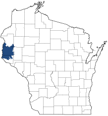
Western Prairie
Ecological Landscape
Download the Western Prairie chapter [PDF] of the Ecological Landscapes of Wisconsin. This chapter provides a detailed assessment of the ecological and socioeconomic conditions of the Western Prairie.
It also identifies important planning and management considerations and suggests management opportunities that are compatible with the ecology of the landscape. The tabs below provide additional information.
- Physical and Biotic Environment
-
Physical and Biotic Environment
Size 1,090 square miles (697,633 acres), representing 1.9% of the land area of the State of Wisconsin. It is the third smallest Ecological Landscape in the state; however, this Ecological Landscape (like the Northwest Lowlands) is part of a larger ecoregion that extends west into Minnesota. Climate Typical of southern Wisconsin; mean growing season of 145 days, mean annual temperature is 43.7 deg. F, mean annual precipitation is 32.1, and mean annual snowfall is 45.4 inches. The climate and topography was favorable to frequent fires that resulted in prairie vegetation occurring in almost a third of the area prior to Euro-American times. The length of the growing season, adequate precipitation, and favorable temperatures make the climate favorable for agriculture, which is prevalent here. Bedrock Bedrock was deposited during the Paleozoic Era (including the Cambrian and Ordovician Periods), and is dominantly marine sandstone and dolomite. Precambrian igneous and metamorphic bedrock lies below the Paleozoic deposits. The walls of the Apple River Canyon feature exposures of Cambrian sandstone, Cambrian shale, and Cambrian and Ordovician dolomites. Similar exposures occur along the lower Kinnickinnic River, below the city of River Falls. Geology & Landforms The Landscape is entirely glaciated. Major landforms are rolling till plain, with end moraine in the northwest and small areas of outwash. Soils Soils are predominantly formed in loamy till glacial deposits, while some are in outwash. A loess cap of aeolian silt is 6 to 48 inches thick over the surface. The dominant soil is well drained and loamy with a silt loam surface, moderate permeability, and moderate available water capacity. Hydrology The Lower St. Croix River forms the western boundary of this Ecological Landscape (however, note that this Ecological Landscape is part of a larger ecological region, Subsection 222 Md, which extends west into Minnesota). Other important though much smaller rivers include the Apple, Kinnickinnic, and Willow. Most of the rivers drain westward to the St. Croix, with several draining south directly into the Mississippi, and a few flowing southeast to the Chippewa. Inland lakes, mostly seepage lakes and ponds, are most common in the northwestern part of the Landscape, in an area known informally as Wisconsin's "Prairie Pothole Region". There are multiple dams on the Willow River, and the Kinnickinnic has been dammed at River Falls. Many wetlands have been lost or severely altered by agricultural activities, which have been widespread and intensive in this productive Landscape. Current Landcover Almost half of the current land cover is agricultural crops and about one third of the area is grasslands, with smaller amounts of forest. open water, open wetlands, and urban areas. The major forest types are maple-basswood and oak-hickory, with lesser amounts of lowland hardwoods. Native coniferous forests are rare, and are limited to a few tamarack swamps and small scattered stands of pine on steep rocky slopes. - Associated Rare Species and Natural Communities
-
Associated Rare Species and Natural Communities

Species of Greatest Conservation Need (SGCN) are associated with habitats (or natural communities) and places on the landscape. Understanding relationships among SGCN, natural communities and ecological landscapes help us make decisions about issues affecting SGCN and their habitat and how to respond. Download the Wildlife Action Plan association score spreadsheet to explore rare species and natural communities associated with this ecological landscape.
- General Management Opportunities
-
General Management Opportunities
Grassland management at multiple scales is a major opportunity in the Western Prairie. Small, scattered remnants of native prairie exist here along with substantial areas of "surrogate grassland" that now provide increasingly critical habitat for many grassland species, especially birds. The largest grassland management project in this Ecological Landscape is the Western Prairie Habitat Restoration Area in St. Croix and Polk counties. By managing at multiple scales, large blocks of surrogate grassland, unplowed prairie pastures, small native prairie remnants on bluffs or within rights-of-way and working agricultural lands can all play key roles in the conservation and restoration of the grassland ecosystem that historically covered most of this ecological landscape. Ponds and lakes border or are embedded within some of the areas with high grassland management potential; these add great value for species that nest near or over water and for migrants that use open wetlands and water.
The Lower St. Croix River supports an exceptionally high diversity of aquatic organisms, including fish, mussels and other invertebrates. Many rare species have been documented here, and several of the mussels are globally rare. The river's floodplain contains good examples of emergent marsh, wet prairie and floodplain forest. The forested slopes of the St. Croix Valley contain rich mesic hardwood forests, dry oak forests and a few stands of natural white pine. Remnant bluff prairies and oak savannas occur on the uppermost slopes above the St. Croix. Migratory bird use of the St. Croix River valley is high, and the river corridor also provides nesting and wintering habitat for many common and rare birds, including species of conservation concern. Protecting the hydrology and water quality of the St. Croix and its tributaries is critical, and assessing areas of high value to birds and other species is an important step in protecting and properly managing the best habitats.
Other important management opportunities include the Kinnickinnic River Corridor; the Apple River Canyon; scattered prairie, savanna and forest remnants (including mesic, dry-mesic and dry forests); coldwater and coolwater streams; and miscellaneous opportunities to protect more isolated populations of rare species and features not covered by the previously mentioned categories.
- Considerations for Property Planning
-
Considerations for Property Planning
Agriculture is the dominant land use, but in recent years residential development has increased dramatically in the western part of the Ecological Landscape along and near the St. Croix River. Many new residents commute to the Twin Cities for work. Public lands are limited, making management at large scales difficult. Prairie remnants are few and most are isolated. Where possible, these should be embedded within surrogate grasslands such as Waterfowl Production Areas, Conservation Reserve Program lands, or other open covertypes to meet the needs of wide-ranging grassland wildlife.
The lower St. Croix River supports many rare aquatic species, but recreational pressure is high and increasing, and residential development is occurring in most areas not yet protected as part of the National Scenic Riverway. Maintaining or restoring high water quality and protecting instream and adjoining wetland and terrestrial habitats are conservation priorities for this Ecological Landscape.
Residents along the Kinnickinnic River in Pierce County have worked together and received grants to restore and manage prairie and savanna remnants, and protect populations of rare species. Similar partnerships have worked in areas along the St. Croix River, and could serve as models for conservation work elsewhere.
- Maps
-
Maps
Printable maps of ecological landscapes are available in the Ecological Landscapes of Wisconsin document and map library.
Many of the map layers, such as Land Type Associations, Conservation Opportunity Areas and Finley’s 1800s vegetation polygons are available to download from the WI DNR GIS Open Data portal.