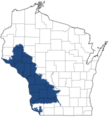
Western Coulees and Ridges
Ecological Landscape
Download the Western Coulee and Ridges chapter [PDF] of the Ecological Landscapes of Wisconsin. This chapter provides a detailed assessment of the ecological and socioeconomic conditions for the Western Coulee and Ridges.
It also identifies important planning and management considerations and suggests management opportunities that are compatible with the ecology of the landscape. The tabs below provide additional information.
- Physical and Biotic Environment
-
Physical and Biotic Environment
Size 9,642 square miles (6,170,674 acres), over 17% of the state, making it the largest of Wisconsin's 16 Ecological Landscapes. Climate Typical of southern Wisconsin; mean growing season of 145 days, mean annual temperature is 43.7 deg. F, mean annual precipitation is 32.6, and mean annual snowfall is 43 inches. Because it extends over a considerable latitudinal area, the climate varies from north to south. The climate is favorable for agriculture, but steep slopes limit intensive agricultural uses to broad ridgetops and parts of valleys above floodplains. The climate variability, along with the rugged ridge and coulee (valley) topography, numerous microhabitats, and large rivers with broad, complex floodplains, allows for a high diversity of plants and animals. Bedrock Mostly Paleozoic sandstones and dolomites of Cambrian and Ordovician age. Precambrian quartzite occurs in the Baraboo Hills, near the eastern edge of the Ecological Landscape. Thin beds of shale occur with other sedimentary rocks in some areas. Bedrock is exposed as cliffs and, more locally, as talus slopes. Geology & Landforms Characterized by its highly eroded, unglaciated topography with steep sided valleys and ridges, high gradient headwaters streams, and large rivers with extensive, complex floodplains and terraces. Ancient sand dunes occur on some of the broader terraces along the Mississippi and Wisconsin rivers. Soils Windblown loess of varying thickness; alluvium in the floodplains. Organic soils, especially peats, are rare. Hydrology Dendritic drainage patterns are well-developed in this mostly unglaciated Ecological Landscape. Natural lakes are restricted to the floodplains of large rivers. Large warmwater rivers are especially important here, and include the Wisconsin, Chippewa, and Black. The Mississippi River forms the Ecological Landscape's western boundary. Numerous spring-fed (coldwater) headwaters streams occur here. Coolwater streams are also common. Current Landcover Current vegetation is a mix of forest (41%), agriculture (36%), and grassland (14%) with wetlands (5%) mostly in the river valleys. Primary forest cover is oak-hickory (51%). Maple-basswood forests (28%), dominated by sugar maple, basswood and red maple, are common in areas that were not burned frequently. Bottomland hardwoods (10%) dominated by silver maple, swamp white oak, river birch, ashes, elms, and cottonwood are common within the floodplains of the larger rivers. Relict "northern" mesic conifer forests composed of hemlock, white pine and associated hardwoods such as yellow birch are rare but do occur in areas with cool, moist microclimates. Dry rocky bluffs may support xeric stands of native white pine, sometimes mixed with red or even jack pine. Prairies are now restricted to steep south- or west-facing bluffs, unplowed outwash terraces along the large rivers, and a few other sites. They occupy far less than 1% of the current landscape. Mesic tallgrass prairies are now virtually nonexistent except as very small remnants along rights-of-way or in cemeteries. - Associated Rare Species and Natural Communities
-
Associated Rare Species and Natural Communities

Species of Greatest Conservation Need (SGCN) are associated with habitats (or natural communities) and places on the landscape. Understanding relationships among SGCN, natural communities and ecological landscapes help us make decisions about issues affecting SGCN and their habitat and how to respond. Download the Wildlife Action Plan association score spreadsheet to explore rare species and natural communities associated with this ecological landscape.
- General Management Opportunities
-
General Management Opportunities
The Western Coulees and Ridges Ecological Landscape offers the best opportunities in the state to maintain many of southern Wisconsin's natural communities. Many rare species have been documented here due to the diversity, scale, types, condition and context of the natural communities present.
Less common natural communities also provide excellent management opportunities here. Conifer relicts, by definition, are almost entirely restricted to the Western Coulees and Ridges, with lesser management opportunities present in the Southwest Savanna. Fire-dependent oak ecosystems are well-represented here include Oak Openings, Oak Barrens, Oak Woodland and dry to mesic oak forests. Bluff prairies and sand prairies are better represented in this Ecological Landscape than anywhere else in Wisconsin and probably better than anywhere else in the Upper Midwest. These fire-dependant communities could be managed in a continuum with savanna and forest communities, wherever possible.
Man-made habitats such as "surrogate grasslands" can be important for many species by increasing the effective size and reducing isolation of small remnant prairies or savannas. Large open habitats can be critical for area-sensitive grassland birds and others. Properly sited and managed dredge spoil islands can provide important habitat for herptiles and birds, especially along the Mississippi River, which has been heavily altered by dam construction, diminished water quality and the impacts of invasive species.
Large warmwater rivers are critical for fish, herptiles, birds and invertebrates, especially mussels and some groups of aquatic insects. The diverse habitats associated with the large river corridors include the main channels, running sloughs, oxbow lakes and ponds, various floodplain wetland communities, terraces with sand prairies and barrens and adjoining mesic to xeric forested bluffs. Managing this mosaic can protect ecotones and connectivity, representing opportunities that are unavailable or limited elsewhere in the state. Other important aquatic features include high concentrations of coldwater and coolwater streams, spring runs and spring seepages.
Bedrock features are important throughout the Western Coulees and Ridges and include cliffs, caves, talus slopes and Algific Talus Slopes. Some bats and reptiles are dependent on caves, tunnels and abandoned mines as roost sites and hibernacula.
- Considerations for Property Planning
-
Considerations for Property Planning
These include: developing public-private partnerships and creating additional conservation lands in the Ecological Landscape's interior; developing reliable and practical methods of regenerating and maintaining the Ecological Landscape's oak ecosystems (including forests, woodlands, and savannas); broadening the incentives available to private landowners to promote the maintenance and restoration of rare communities such as oak savannas and oak woodlands, as well as underrepresented forest patch sizes and shapes and developmental stages (these include large patches, connecting corridors, and older forests); better land management and land use planning for floodplains, watersheds, and headwaters areas; clarifying successional patterns of forest communities affected by dams and the suppression of fire, and restore functional dynamics where possible; seeking opportunities to reduce habitat fragmentation and isolation, and increase ecological connectivity; incorporating major environmental gradients into conservation projects where possible; earlier detection and better control of invasive species (many are now established in parts of the Western Coulees and Ridges and they must be addressed in survey, management, monitoring and protection plans. Some of the most heavily visited areas in this Ecological Landscape are badly overrun by invasive plants, and control or eradication efforts should be priorities here and be a component of ALL land and water management activities. Such infestations are likely to be spread by tourists and resource professionals alike). Educating the public about the harmful effects of non-native earthworms and other invasive plants and animals is an outreach priority.
Major dams have been constructed on the Mississippi River, significantly altering and fragmenting aquatic habitats there, but long free-flowing stretches of the Wisconsin, Chippewa and Black rivers still exist in this Ecological Landscape.
In many parts of this Ecological Landscape significant developments occur on the relatively level terraces between the floodplains of large rivers and steeply sloping adjacent bluffs. The terraces are intensively used for agriculture and residential development, and as sites for railroad, highway, and utility corridors. Cities and villages now occupy many of the broader terraces, especially where tributaries join the Mississippi River, and residential areas continue to expand on such lands. Opportunities to keep uplands and floodplains connected are relatively scarce and should be regarded as conservation priorities. The sand terraces support rare species and imperiled habitats and therefore have high intrinsic values; they also serve as ecologically important connectors across ecosystems and environmental gradients.
Sand mining has increased greatly in recent years (mostly for use in "fracking" elsewhere in North America). Impacts are currently under review but they could be widespread as Wisconsin has high potential to provide raw materials for this purpose.
- Maps
-
Maps
Printable maps of ecological landscapes are available in the Ecological Landscapes of Wisconsin document and map library.
Many of the map layers, such as Land Type Associations, Conservation Opportunity Areas and Finley’s 1800s vegetation polygons are available to download from the WI DNR GIS Open Data portal.