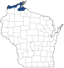
Superior Coastal Plain
Ecological Landscape
Download the Superior Coastal Plain chapter [PDF] of the Ecological Landscapes of Wisconsin. This chapter provides a detailed assessment of the ecological and socioeconomic conditions for the Superior Coastal Plain.
It also identifies important planning and management considerations and suggests management opportunities that are compatible with the ecology of the landscape. The tabs below provide additional information.
- Physical and Biotic Environment
-
Physical and Biotic Environment
Size 1,416 square miles (905,929 acres), representing 2.5% of the area of the state. Climate Typical of northern Wisconsin, though conditions are somewhat moderated by the proximity to Lake Superior; mean growing season of 122 days, mean annual temperature is 40.2 deg. F, mean annual precipitation is 32 inches, and mean annual snowfall is 87.4 inches. Cool summers, deep snows (including lake effect snows), high humidity, fog, mist, wave spray, currents, ice, and strong winds (e.g., along exposed coastlines, where blow-down events are frequent) affect parts of the Ecological Landscape, especially near Lake Superior. Some areas near Lake Superior support grass-based agriculture (18.5% of the Ecological Landscape). Portions of the northern Bayfield Peninsula have a climate and soils favorable for growing apples and other fruits. Areas away from Lake Superior have a shorter growing season and forests become more important than agriculture. Bedrock Late Precambrian sandstones are exposed and form cliffs and ledges along the northern edge of the Bayfield Peninsula and on the shores of the Apostle Islands. Igneous rocks (e.g., basalts) form the underpinnings of several waterfalls. Geology & Landforms The Bayfield Peninsula is hilly, as are some of the Apostle Islands. Both are covered by glacial tills. The level plains on either side of the Bayfield Peninsula slope gently toward Lake Superior. They are dissected by many deeply incised streams and several large rivers that generally flow from south to north toward Lake Superior. Sandspits, often enclosing lagoons and wetlands, are well-developed in the Apostle Islands archipelago and at river mouths; some of the larger spits are several miles long. Soils Important soils include deep, poorly-drained reddish lacustrine clays on either side of the Bayfield Peninsula. The clay deposits include lenses of sand or coarse-textured till; these areas are especially erosion-prone when they are cut by streams. The tills covering the Bayfield Peninsula and Apostle Islands are variable in composition, but include clays, silts, loams and sands. Organic soils are limited in extent, occurring mostly in association with the peatlands on the margins of the coastal lagoons and to a lesser extent in basins underlain by impermeable tills. Hydrology Lake Superior has had an enormous influence on the climate, landforms, soils, vegetation, and economy of the Superior Coastal Plain. Freshwater estuaries are present along the coast. Inland lakes are rare, but lagoons, some of them quite large, occur behind the coastal sandspits. Important rivers include the St. Louis, Nemadji, Bad, White, Amnicon, and Bois Brule. Coldwater streams originate in the aquifers at the northern edge of the Northwest Sands in Bayfield County and flow north across the Superior Coastal Plain before emptying into Lake Superior. Many of the streams flowing across the clay plain suffered severe damage to their banks and beds during the era of heavy logging in the late 19th and early 20th centuries. Some of them have not yet recovered and their slumping banks continue to dump sediments into the main channels, and ultimately, into Lake Superior. Water (and soil) management can be challenging in this Ecological Landscape. Current Landcover Aspen-dominated boreal forests are abundant on the clay plains to the west and east of the Bayfield Peninsula. In some areas white spruce, balsam fir, and white pine (these were the dominant canopy trees prior to the Cutover) are now common understory species, or are even colonizing abandoned pastures. Older stands of boreal conifers still occur in a few places, such as the City of Superior Municipal Forest. Forest fragmentation is significant on the clay plain owing to the interspersion of forests with fields and pastures. Northern hardwood and hemlock-hardwood forests occur on the Apostle Islands and include old-growth remnants. Dry forests of pine and oak are scarce in this Ecological Landscape but they do occur on some of the sandspits associated with coastal estuaries. The largest coastal wetlands cover thousands of acres, and these are composed of complex vegetation mosaics that include coniferous and deciduous forests, shrublands, wet meadows and marsh. Large wetlands in the interior of the Superior Coastal Plain include the Bibon Swamp, a huge wetland of almost 10,000 acres along the White River on the southern edge of the Ecological Landscape, and Sultz Swamp, a peatland perched high on the northern Bayfield Peninsula. An extensive complex of wetlands of variable structure occurs on poorly drained red clays in and around the City of Superior. - Associated Rare Species and Natural Communities
-
Associated Rare Species and Natural Communities

Species of Greatest Conservation Need (SGCN) are associated with habitats (or natural communities) and places on the landscape. Understanding relationships among SGCN, natural communities and ecological landscapes help us make decisions about issues affecting SGCN and their habitat and how to respond. Download the Wildlife Action Plan association score spreadsheet to explore rare species and natural communities associated with this ecological landscape.
- General Management Opportunities
-
General Management Opportunities
Lake Superior, the largest freshwater lake in the world, affects virtually all natural features and many economic aspects of the Superior Coastal Plain. Continued cooperation and coordination across county, state and international boundaries will be needed to manage this globally important resource sustainably over time.
The freshwater estuaries in this landscape are exceptional and offer opportunities to protect or restore many high quality wetland habitats. The National Oceanic and Atmospheric Administration (NOAA) recently designated the St. Louis River Estuary as part of a nation-wide system of "National Estuarine Research Reserves." This designation will present opportunities for coastal wetland-related research, stewardship and education through private, state and federal partnerships. The Bad River-Kakagon Sloughs was designated a "wetland of international significance" in 2012 through the Ramsar Convention.
The Superior Coastal Plain offers excellent opportunities to maintain high-quality examples of many natural community types. The "sandscapes," with their beach, dune, barrens and dry forest communities, are among the best examples known from the western Great Lakes region. Bedrock features include cliffs, glades and ledges, and these provide habitat for a number rare plants, some of them at their extreme range limits. The extensive red clay wetlands in and around the city of Superior host exceptional concentrations of rare plants.
Boreal Forest once covered much of the Superior Coastal Plain, and the landscape presents the state's best opportunities to protect, restore and maintain this natural community. Returning conifers to these forests now largely dominated by aspen is a major opportunity. Collectively, these forests also provide opportunities to increase large trees, cavity trees, coarse woody debris, patches of old-growth forest, large forest patches and a reduction of the hard edge that is now prevalent throughout much of this region. Old-growth hemlock-hardwood forests, now extremely rare anywhere in Wisconsin, occur on several of the Apostle Islands. Browse-sensitive conifers (hemlock, white cedar, Canada yew) are common and reproducing well in these forests.
Several of the major river corridors, such as the Bad and Nemadji, contain stands of floristically rich mesic hardwood forests and the state's northernmost occurrences of floodplain forest. Streams coming out of the deep sand aquifers on the northern Bayfield Peninsula support coldwater assemblages, which include native brook trout and numerous other species.
Significant opportunities to maintain breeding and migratory habitats in both natural and human caused or "surrogate" communities are found in this landscape. For example, colonial bird rookeries are significant and include the only breeding sites on Lake Superior for the WI Endangered Common Tern. Some of the grass-dominated cleared lands in the lacustrine clay plain are extensive for this part of the state and are inhabited by rare and declining grassland birds. These grassland areas offer opportunities for careful assessment to determine which are best to maintain for their habitat value versus increasing the size of forest blocks to increase forest area, reduce forest edge, retain snow cover and water for longer periods and provide habitat for forest interior species that are now relatively scarce in many parts of the Superior Coastal Plain.
- Considerations for Property Planning
-
Considerations for Property Planning
Major planning and management considerations in the Superior Coastal Plain include climate change; impacts of water level changes on the coastal wetlands and associated biota (including attempts to stabilize the water level of Lake Superior); the continued appearance and spread of invasive species; population trends in certain native species; managing water on the clay soils; and increasing the acreage of conifer-dominated boreal forest. Other important issues are shoreline development along rivers and Lake Superior and protection of areas used by migratory birds and spawning fish. Management of lands in the red clay country to lessen erosion and improve water quality and habitat for aquatic life, and reduce negative edge impacts (construction, agriculture, forestry - including reforestation), are issues deserving major consideration. The occurrences of many rare and geographically limited natural communities of exceptional quality have been documented here recently, along with numerous associated rare species. The coastal estuaries are regionally significant repositories for intact natural communities, such as conifer swamp, sedge meadow, fen, and marsh. Many rare plants and animals have been documented in the estuaries, which are also important nursery areas for fish. Use of some of these coastal wetlands, lagoons and associated sandspit habitats by migratory birds is very high, and some of the rare species use these habitats to the exclusion of most or any others.
- Maps
-
Maps
Printable maps of ecological landscapes are available in the Ecological Landscapes of Wisconsin document and map library.
Many of the map layers, such as Land Type Associations, Conservation Opportunity Areas and Finley’s 1800s vegetation polygons are available to download from the WI DNR GIS Open Data portal.