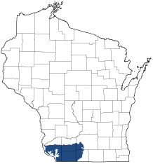
Southwest Savanna
Ecological Landscape
Download the Southwest Savanna chapter [PDF] of the Ecological Landscapes of Wisconsin. This chapter provides a detailed assessment of the ecological and socioeconomic conditions for the Southwest Savanna.
It also identifies important planning and management considerations and suggests management opportunities that are compatible with the ecology of the landscape. The tabs below provide additional information.
- Physical and Biotic Environment
-
Physical and Biotic Environment
Size 1,950 square miles (1,248,126 acres); 3.5% of the land area of Wisconsin. Climate Typical of southern Wisconsin; the mean growing season is 153 days, mean annual temperature is 45.6 deg. F, mean annual precipitation is 35.2, and mean annual snowfall is 39.9 inches. However, the Southwest Savanna has the fourth longest growing season, the most precipitation, the third lowest snowfall, and second warmest January low temperature among Ecological Landscapes in the state. The climate tends to be warmer in the southwestern part of the state, which affects the ecology of the Southwest Savanna and also makes it suitable for most agricultural uses. 80% of this Ecological Landscape is devoted to row crops, small grains, and pastures. Bedrock The Southwest Savanna Landscape is underlain by sedimentary bedrock, especially dolomites and sandstones. Geology & Landforms The Southwest Savanna is part of Wisconsin's Driftless Area, a region that has not been glaciated for at least the last 2.4 million years. The topography is characterized by broad, open ridgetops, deep valleys, and steep, wooded slopes. Soils Soils on hilltops are silt loams mostly silt loams. In some areas soils are shallow, with bedrock or stony red clay subsoil very close to or at the surface. In other locales the ridgetops have a deep cap of loess-derived silt loam (these are the most productive agricultural soils). Valley soils include alluvial sands, loams, and occasionally, peats. Hydrology The drainage patterns of streams in the Southwest Savanna are dendritic, which is a pattern characteristic of unglaciated regions but absent or uncommon in most of Wisconsin. Flowing waters include warmwater rivers and streams, coldwater streams, and springs. Natural Lakes are virtually absent, though there are a few associated with the floodplains of the larger rivers. Natural lakes are rare but there are a few in the floodplains of the larger rivers, such as the Pecatonica. Impoundments and reservoirs have been constructed on some rivers and streams, and check dams have been built in ravines to hold storm and snow runoff. Current Landcover Agricultural crops (corn, soybeans, small grains, hay) cover 70% of this Ecological Landscape, with lesser amounts of grassland (mostly pasture), forest, and residential areas. The major forest types are oak-hickory and maple-basswood. Prairie remnants of varying quality persist in a few places, mostly on rocky hilltops or slopes that are too steep to farm. Some pastures have never been plowed, and those that historically supported prairie may retain remnants of the former prairie flora. Pastures with scattered open-grown oaks still exist in some areas, mimicking oak savanna structure. A complement of native plants persists in some of these pastured savannas. - Associated Rare Species and Natural Communities
-
Associated Rare Species and Natural Communities

Species of Greatest Conservation Need (SGCN) are associated with habitats (or natural communities) and places on the landscape. Understanding relationships among SGCN, natural communities and ecological landscapes help us make decisions about issues affecting SGCN and their habitat and how to respond. Download the Wildlife Action Plan association score spreadsheet to explore rare species and natural communities associated with this ecological landscape.
- General Management Opportunities
-
General Management Opportunities
The Southwest Savanna was once dominated by fire-dependant natural communities representing the continuum of prairie, oak savanna, oak woodland and oak forest. Now dominated mostly by agricultural lands, and with less than one percent in public ownership, this landscape still offers good opportunities to maintain expansive grassland and savanna habitats through public / private partnerships. Restoration and management of the entire continuum of fire-dependent natural communities native to southern Wisconsin is possible here.
This is arguably Wisconsin's best ecological landscape to manage grasslands at large scales. Native grasslands are rare here, as they are throughout the upper Midwest. However, some of the scattered remnants support rare plants, invertebrates, herptiles, birds and other animals. In addition, abundant surrogate grasslands can provide the scale needed by area-sensitive species and in some cases can connect isolated prairie patches. Large areas of surrogate grasslands can buffer prairie and savanna remnants from more intensively managed land, and there are sometimes opportunities to embed remnants within large acreages of CRP, fallow agricultural land, pasture, or cropland. The surrogate grasslands may also provide missing environmental gradients of soil types, soil moisture, slope and aspect, which may be needed for the vegetation to adapt to long-term environmental changes.
The Wisconsin Natural Resources Board recently approved a project that will protect and restore grassland and stream habitats in this Ecological Landscape: the "Southwest Wisconsin Grasslands and Streams Conservation Area." The project boundary encompasses high-priority grasslands, prairies, savanna remnants and watersheds across parts of southern Iowa, northern Lafayette, southwest Dane and far northwestern Green counties. This project represents major habitat management opportunities via numerous private-public partnerships.
Extensive areas of grazed but never plowed oak savanna occur at several locations in the Southwest Savanna. Survey needs include the identification of prairie remnants, unplowed prairie and savanna pastures and other sites with diverse native flora. Floristically diverse remnants adjoining or embedded within extensive surrogate grasslands will offer the best restoration and management opportunities.
Rivers and streams here afford opportunities to manage and conserve native aquatic species and their habitats as well as recreational opportunities. The identification of aquatic habitats known to support sensitive species provides a starting point on which to focus restoration and protection efforts. Some sites will offer good opportunities to merge terrestrial and aquatic conservation projects.
Miscellaneous management opportunities in the Southwest Savanna include scattered hardwood forests, conifer relicts, springs and spring runs and rare species populations. At some sites there are good opportunities to maintain, restore and manage these features, including restoration of oak forests that are succeeding to more shade and browse-tolerant species. Conifer relicts could be mapped and monitored. The long-term viability of these relicts, especially Hemlock Relicts, is unknown and needs further investigation.
- Considerations for Property Planning
-
Considerations for Property Planning
The need for partnerships between government agencies, NGOs, and private individuals are critical as less than 1% of the Ecological Landscape is publicly owned. Coordinated management of large areas will be difficult because of ownership patterns and the prevalence of intensively used agricultural land. Remnant prairies and savannas are small and often isolated, but in a few areas there are opportunities to develop partnerships that will accommodate a mix of active cropland, pasture, conservation reserve program lands, and reserves that feature high quality prairie and savanna remnants or other habitats known to be especially important to rare or otherwise sensitive species, including streams. The Southwest Wisconsin Grassland and Stream Conservation Area, a cooperative project involving many public and private partners, encompasses one of the best locations to accomplish this and is an excellent place in which to focus some of the grassland protection efforts at larger scales.
- Maps
-
Maps
Printable maps of ecological landscapes are available in the Ecological Landscapes of Wisconsin document and map library.
Many of the map layers, such as Land Type Associations, Conservation Opportunity Areas and Finley’s 1800s vegetation polygons are available to download from the WI DNR GIS Open Data portal.