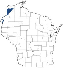
Northwest Lowlands
Ecological Landscape
Download the Northwest Lowlands chapter [PDF] of the Ecological Landscapes of Wisconsin. This chapter provides a detailed assessment of the ecological and socioeconomic conditions for the Northwest Lowlands.
It also identifies important planning and management considerations and suggests management opportunities that are compatible with the ecology of the landscape. The tabs below provide additional information.
- Physical and Biotic Environment
-
Physical and Biotic Environment
Size 675 square miles (431,842 acres), representing 1.2% of the land area of the State. This is Wisconsin's smallest Ecological Landscape but it adjoins, and outside of Wisconsin is considered part of, a much larger ecoregion that extends to the west into Minnesota. Climate Typical of northern Wisconsin; the mean growing season is 122 days, mean annual temperature is 41.8 deg. F, mean annual precipitation is 30.6, and mean annual snowfall is 49 inches. The cool temperatures and short growing season are not adequate to support agricultural row crops; less than three percent of the land here is used for agricultural purposes and most of this is in the southern "hook" in Burnett County. The climate is favorable for forests, which cover almost 70% of the Ecological Landscape. The cool temperatures and short growing season, along with numerous and large acid peatlands, result in almost boreal-like conditions in parts of the Northwest Lowlands. Bedrock Bedrock outcroppings are rare except in association with the basalt ridge that follows the Douglas County fault line and forms part of the northern boundary of the Northwest Lowlands. Waterfalls, cliffs, bedrock glades, and rock-walled gorges are associated with this bedrock feature. Local, relatively small, exposures of sandstones and conglomerates occur in some of these gorges. Geology & Landforms The major landforms are ground and end moraines, with drumlins present in the southwestern portion. Topography is gently undulating. In the northern part of the Ecological Landscape many stream valleys run northeast-southwest in roughly parallel courses. This is caused by bedrock ridges that were created by harder strata of lava alternating with weaker sedimentary rocks; these were later tilted upward due to rifting and continental collision. This bedrock feature influences the surface topography of the Northwest Lowlands, especially where glacial deposits are thin. Soils Soils are predominantly loams, with significant acreages of peat deposits in the poorly drained lowlands. Major river valleys have soils formed in sandy to loamy-skeletal alluvium or in non-acid muck. Alluvial soils range from well drained to very poorly drained, and have areas subject to periodic flooding. Hydrology This Ecological Landscape occupies a major drainage divide, and contains the headwaters of many streams that flow north toward Lake Superior or south toward the St. Croix River system. Important rivers include the St. Croix, Black, Tamarack, Spruce, and Amnicon. Lakes are uncommon except in the heavily agricultural southernmost part of the Ecological Landscape in Burnett County. Impoundments, all fairly small, have been created by constructing dams on the Tamarack and Black rivers, and several creeks. The St. Croix River is fed by springs, spring ponds, and seepages. Current Landcover The present-day forests remain extensive and relatively unbroken, occupying about 68% of the landscape. Forests consist mainly of aspen, paper birch, sugar maple, basswood, spruce and fir. Minor amounts of white pine, red pine and red oak are also present. Older successional stages are currently rare, as almost all of this land is managed as "working forests". The large undisturbed peatland complexes consist of mosaics of black spruce-tamarack swamp, muskeg, open bog, poor fen, shrub swamp, and occasionally, white cedar swamp. The St. Croix River corridor includes forested bluffs and terraces, which support communities unlike those found in most other parts of the Ecological Landscape. These include mesic maple-basswood forest, dry-mesic forests of oak or oak mixed with pine, black ash-dominated hardwood swamps, and numerous forested seeps. Less extensive areas of marsh and sedge meadow also occur along the St. Croix. In most of this Ecological Landscape minor amounts of land are devoted to agricultural and residential uses, and most of these land uses are concentrated along State Highway 35. The major exception to this pattern is the area that wraps around the south end of the Northwest Sands which is a mix of agricultural lands and scattered oak or oak-pine woodlots. - Associated Rare Species and Natural Communities
-
Associated Rare Species and Natural Communities

Species of Greatest Conservation Need (SGCN) are associated with habitats (or natural communities) and places on the landscape. Understanding relationships among SGCN, natural communities and ecological landscapes help us make decisions about issues affecting SGCN and their habitat and how to respond. Download the Wildlife Action Plan association score spreadsheet to explore rare species and natural communities associated with this ecological landscape.
- General Management Opportunities
-
General Management Opportunities
The Northwest Lowlands is one of the few Wisconsin Ecological Landscapes with large areas of remote habitat. The northern portion of the Northwest Lowlands features extensive forests undisturbed wetlands that are largely unbroken by farms, urban areas, or other developments and only a few major roads cross this portion of the landscape. Maintaining this large, contiguous area of undeveloped and lightly roaded forest is a major opportunity. In addition, there are opportunities to develop and maintain older forest, increase structural attributes associated with older forests and identify high conservation value forests on public lands. Areas with the potential to increase the diminished conifer component could also be identified; areas adjacent to existing stands of lowland conifers and muskeg might be especially good candidates for this.
There are several opportunities to work with partners across administrative (federal, state, county, private) boundaries. For example, the Northwest Lowlands is a small part of an ecoregion that extends well into Minnesota. Black Lake Bog, a two-state designated Natural Area on the MN-WI state line, provides opportunities to cooperate and coordinate management with Minnesota DNR for wide-ranging fauna such as gray wolf, moose, some birds and the habitat these species require. The National Park Service (NPS) has primary stewardship responsibilities for resources in and immediately adjacent to the St. Croix River. State, county and private entities have opportunities to continue to work with NPS on basic inventory, monitoring and management projects pertinent to this area. In general, there are good opportunities to provide and maintain corridors for species moving within the landscape, as well as to and from other landscapes.
The St. Croix River is an exceptional aquatic resource and supports outstanding aquatic diversity with numerous rare species. The forested corridor along the upper St. Croix also supports significant populations of rare birds. Maintaining an unbroken natural landscape and protecting stream corridors (e.g., the Spruce and Tamarack rivers) and the watersheds of streams that flow into the St. Croix River is important for maintaining the high-quality aquatic habitats, recreational opportunities and aesthetic values of this ecosystem. Several streams, such as the Black and Amnicon rivers, originate in this Ecological Landscape, flow north to Lake Superior and offer opportunities to maintain important aquatic and shoreline habitats and contribute to high water quality within the Northwest Lowlands and beyond.
The large, intact peatlands here are outstanding natural features and contain some of Wisconsin's best examples of peatland communities. Many sensitive species are dependent on these wetlands to provide suitable breeding and foraging habitat. Several of the large wetlands have been identified as high conservation priorities and merit the strongest protection possible. In addition, these wetlands are the headwaters areas of some of the Northwest Lowlands most important streams.
- Considerations for Property Planning
-
Considerations for Property Planning
Avoid fragmentation of extensive forests, wetlands, and potential travel and dispersal corridors, e.g., via infrastructure development, or management activities; select a subset of forest interior species to monitor; identify opportunities to increase older forest, the abundance of conifers, and large forest patches; conduct aquatic surveys of headwaters streams; assess adequacy of protection for the aquatic and terrestrial resources of the St. Croix-Namekagon river system and identify opportunities to increase that protection if and where it's needed. The St. Croix corridor is used heavily by migratory birds, and may be important for other taxa as well. Ensure that DNR property managers have the background and inventory information they need to develop new property master plans. Communicate across jurisdictional borders to increase awareness of issues beyond individual property boundaries and enhance management compatibility where that would be advantageous.
- Maps
-
Maps
Printable maps of ecological landscapes are available in the Ecological Landscapes of Wisconsin document and map library.
Many of the map layers, such as Land Type Associations, Conservation Opportunity Areas and Finley’s 1800s vegetation polygons are available to download from the WI DNR GIS Open Data portal.