Critical Habitat Areas
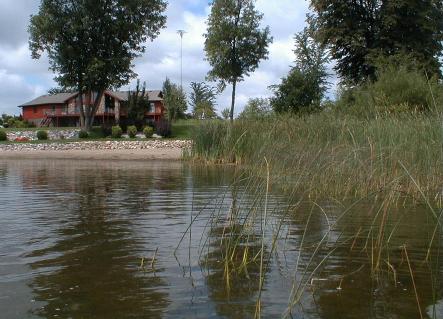
Every waterbody has critical habitat - those areas that are most important to the overall health of the aquatic plants and animals. Remarkably, 80 percent of the plants and animals on the state's endangered and threatened species list spend all or part of their life cycle within the near shore zone. As many as 90 percent of the living things in lakes and rivers are found along the shallow margins and shores.
Wisconsin law mandates special protections for these critical habitats. Critical Habitat Designation is a program that recognizes those areas and maps them so that everyone knows which areas are most vulnerable to impacts from human activity. A critical habitat designation assists waterfront owners by identifying these areas up front, so they can design their waterfront projects to protect habitat and ensure the long-term health of the lake they where they live.
Areas are designated as Critical Habitat if they have Public Rights Features, Sensitive Areas or both. Public rights features (defined in NR 1.06, Wis. Adm. Code) include the following:
- fish and wildlife habitat;
- physical features of lakes and streams that ensure protection of water quality;
- reaches of bank, shore or bed that are predominantly natural in appearance; and
- navigation thoroughfares;
Critical Habitat Designation Process
Selection of waters for Critical Habitat Designation is generally done as part of the DNR's biennial work planning process. This selection contemplates three basic factors:
- quality of the resource;
- amount of knowledge and information the Department holds regarding the water body; and
- current and future risks of the resource to riparian development and in-lake activities.
After a lake is selected, DNR field staff compile and review the most current scientific data about the water body. Data is also solicited from local units of government, conservation organizations, federal agencies, local businesses and anyone who may have resource knowledge and information. This information is used to assemble maps to identify targets of focus related to fish, wildlife, endangered resources and their habitats.
Next, DNR staff conduct field work and surveys to identify public rights features on the lake and delineate their extent. The resulting maps and supporting data are compiled into a draft Critical Habitat Designation report, which is posted on the DNR's website for public review. The DNR must also give notice of the draft report to the local media, the county clerk and legislators. If requested or if concerns are anticipated, DNR typically holds informational meetings to answer questions and receive comments. Once public comment is received and the report is complete, Critical Habitat Designations are posted on the DNR website.
How This Program Affects Waterfront Owners
Critical Habitat Designations provide advance information to waterfront owners, to clarify the regulations that will apply when they want to do a construction project or activity along their shoreline. If a project is proposed in a designated Critical Habitat area, the permit jurisdiction or the permit process may change. This allows DNR to ensure that proposed projects will not harm these sensitive resources.