Wolf River State Trail (Langlade County)
Property Master Plan
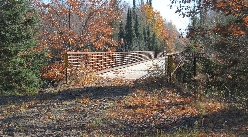
The Wolf River State Trail in Langlade County is a DNR rail-trail used for hiking, biking, snowshoeing, cross-country skiing (ungroomed), ATV/UTV riding and snowmobiling. All DNR lands are open to foot travel, unless posted as closed. Specific segments of the existing trail within the county limit different recreational uses (e.g. ATV/UTV). The full length of the Wolf River State Trail corridor extends 44 miles (north-south) on a former rail corridor from the Menominee and Langlade County line, north through Langlade County and into Forest County, currently ending in the city of Crandon.
The Forest County portion of the trail is managed in partnership with the county and was planned in the North Central Forest Regional Master Plan (approved April 2026). The second half of the trail runs through Langlade County, and until April 2026, had been managed in partnership with Langlade County.
Wolf River State Trail
Planning Update
On May 27, 2026, the Wisconsin Natural Resources Board (NRB) approved the department's request to initiate a master planning process for the Langlade County portion of the Wolf River State Trail.
Planning authority for the Langlade County portion of the trail was returned to the department when the agreement terminated (April 2026) after the draft North Central Forest regional master plan was posted for public review. Therefore, the department is pursuing an individual property plan for the Langlade County portion of the property which will guide future development, natural resource and recreation management of the trail.
This master plan will only apply to the segments of the Wolf River State Trail within Langlade County. The existing length of trail in Langlade County is 23.4 miles, 2.5 miles of which is currently undeveloped along the southernmost end of the trail within Langlade County.
Have Your Voice Heard!
During this scoping phase of the planning process, the public is invited to share their thoughts on the existing and future use and management of Wolf River State Trail in Langlade County and to help identify topics that should be addressed in the plan. The department will use the information gathered from this initial scoping process, in addition to other information sources, as it develops the master plan for the property.
The public is invited to provide comments using any of the methods outlined below. The scoping public input period is open June 23 to July 31, 2026. Public input and information submitted during the public input period and through the development of the WRST master plan will be saved as a part of the public record.
Online Input Form
Submit your comments online using this form.
Hard Copy Input Form
Download and print this form to submit your comments via U.S. Mail.
Attend an In-Person Open House Meeting
Wednesday, July 15, 2026, 5:30 to 7 p.m.
Antigo Public Library
McGinley Room/Large Meeting Room
617 Clermont Street
Antigo, WI 54409
The public will have the opportunity to view informational materials, speak with DNR staff during the open house and submit comments. DNR staff will give a short presentation about the property and master planning process at 6 p.m.
For those unable to attend the public meeting, a presentation providing an overview of the planning process has been pre-recorded.
Watch the Wolf River State Trail (Langlade County) Master Plan Public Scoping Presentation.
Questions or comments can also be submitted to:
Email: Dominique.Swangstu@wisconsin.gov
Phone: 920-492-8822
U.S. Mail
Wisconsin Department of Natural Resources
C/O Dominique Swangstu, DNR Property Planner
1027 W. St. Paul Ave.
Milwaukee WI 53233
Maps
View the property in the interactive Property Planning Viewer.
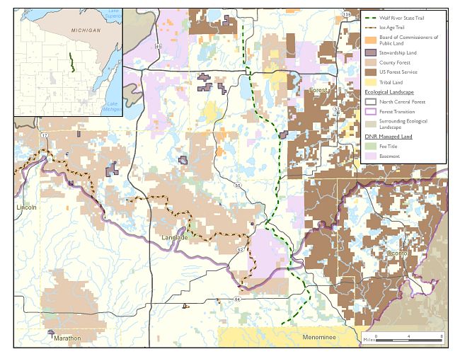
Regional Locator Map