Western Coulees and Ridges
Regional Master Plan
The department has initiated a regional master planning process for the Western Coulees and Ridges Ecological Landscape, which includes most or all of Buffalo, Crawford, Dunn, Eau Claire, La Crosse, Monroe, Pepin, Richland, Sauk, Trempealeau and Vernon counties and portions of Barron, Chippewa, Clark, Columbia, Dane, Grant, Iowa, Jackson, Juneau, Pierce and St. Croix counties.
The department manages over 167,000 acres of land in this region in a series of fishery and wildlife areas, natural areas, parks, recreation areas, trails and a variety of other property types including stewardship demonstration forests, water access sites and parcels acquired under different statewide authorities. Some of the more popular or well-known properties that will be part of this master plan include Governor Dodge, Perrot and Wyalusing state parks; the 400, Elroy-Sparta and Great River state trails; Big Creek, Black Earth Creek, Buffalo River, Coon Creek, Trout Creek and Willow Creek fishery areas; Coulee Experimental Forest; Hogback Prairie, Pewits Nest and Rush Creek state natural areas; and Blackhawk Lake, Kickapoo, Muddy Creek and Van Loon wildlife areas.
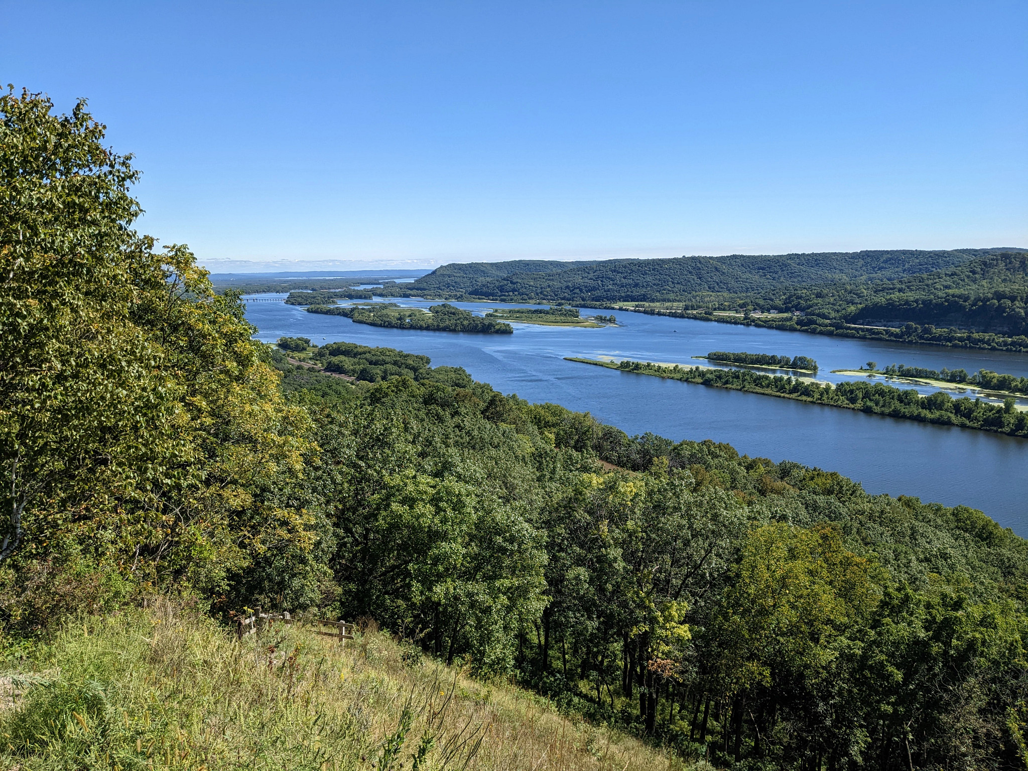
View of the Mississippi River and bluffs from Perrot State Park.
Planning Update
The Western Coulees and Ridges Draft Regional Master Plan and Environmental Analysis is now available for public review and comment. The comment period is open through July 10, 2026.
- Executive summary (7 MB) [PDF]
- Full plan document with maps (139 MB) [PDF]
- Full plan document without maps (43 MB) [PDF]
- Maps only (102 MB) [PDF]
Hard copies of the draft plan are also available at the following public libraries:
- L.E. Phillips Memorial Public Library, 400 Eau Claire Street, Eau Claire WI 54701
- La Crosse Public Library, 800 Main Street, La Crosse WI 54601
- McIntosh Memorial Library, 205 South Rock Avenue, Viroqua WI 54665
- Brewer Public Library, 325 North Central Avenue, Richland Center WI 53581
- Prairie du Chien Memorial Library, 125 South Wacouta Avenue, Prairie du Chien WI 53521
- Dodgeville Public Library, 139 Iowa Street, Dodgeville WI 53533
- George Culver Community Library, 615 Phillips Boulevard, Sauk City WI 53583
- Main Branch Madison Public Library, 201 W Mifflin Street, Madison WI 53703
Have Your Voice Heard!
The public is invited to provide comments using any of the methods outlined below.
Online Input Form
Submit your comments online using this form.
Hard Copy Input Form
Download and print this form to submit your comments via U.S. Mail.
Attend an In-Person Open House Meeting
Wednesday, May 27, 2026 from 5:30 to 7:30 p.m.
L.E. Phillips Memorial Public Library, Riverview Room
400 Eau Claire St
Eau Claire Wisconsin 54701
Thursday, May 28, 2026 from 5:30 to 7:30 p.m.
Richland Center High School, West Commons
1996 US Highway 14 W
Richland Center WI 53581
The public will have the opportunity to view informational material, speak with DNR staff during the open house, and submit comments. DNR staff will give a short presentation about the draft regional master plan at 6 p.m.. The meetings will cover the same information; you do not need to attend both.
For those unable to attend the public meetings, a presentation providing an overview of the draft plan has been pre-recorded.
Watch the draft regional master plan overview presentation
Contact Information
Questions or comments can also be submitted to:
Yoyi Steele, Property Planner
Email: Yoyi.Steele@wisconsin.gov
Phone: 608-590-6027
U.S. Mail: Wisconsin Department of Natural Resources
C/O Yoyi Steele, DNR Property Planner
101 S Webster St.
P.O. Box 7921
Madison WI 53707-7921
The public comment period is open through July 10, 2026.
The map below shows the location of many of the properties in this planning process. Of the properties included, 11 have master plans that were developed under the current planning process described in Chapter NR 44, Wis. Admin. Code. The development of the Western Coulees and Ridges regional master plan will be an opportunity to make adjustments, if any are needed, to the management of these properties. There are over 165 properties without a master plan or with plans developed before the current NR 44 process was instituted; these properties will be the focus of this planning effort.
Click the map below to read about the properties and management considerations for each. If the map is not loading, please be sure your pop-up blocker is turned off.
Access a full-screen version of the Interactive Map of Western Coulees and Ridges Regional Master Plan Properties.
Ecological Characteristics and Management Opportunities
The Western Coulees and Ridges Ecological Landscape (WCR EL) covers over 9,642 square miles in western Wisconsin or 17.4% of the state’s total area, making it the largest of Wisconsin’s 16 ecological landscapes. It is in a unique region known as the Driftless Area, so called because the area was missed by the most recent continental glaciation that affected surrounding areas of Wisconsin and the upper Midwest, and lacks the glacial sediments (known as “drift”) and other glacial landforms found elsewhere in the state. The WCR exhibits characteristic Driftless Area topography, which has been heavily influenced by the erosive effects of flowing water and is deeply dissected and eroded with steep-walled valleys, ridges and escarpments. Much of the WCR is covered by loess, a wind-deposited silty material that forms a fertile soil. Some larger valleys, particularly in the northern part of the EL, have soils formed from outwash sands carried by rivers and streams from glaciated areas to the north.
The WCR is distinctive in that the water in the region is mostly rivers and streams rather than lakes. The state’s largest rivers, including the Mississippi, Wisconsin, Chippewa and Black, border or pass through the region. Most of the region’s wetlands are associated with the floodplains of these large rivers. There are also hundreds of smaller named and unnamed streams. Cold, spring-fed headwaters streams are common in many parts of the region. The WCR has the highest number of springs of any EL in state; these are critical contributing water sources for many of the region’s coldwater stream systems. Water quality in the region is mixed and ranges from quite good in large-river systems like the Chippewa, Black and Wisconsin, which originate in heavily forested areas farther north, to degraded in many streams affected by loss of adjoining forests and wetlands, soil erosion from agricultural fields, and urban stormwater runoff.
Historical vegetation in the WCR was heavily dominated by oak communities, containing the state’s most extensive area of oak forest, oak openings, and oak woodland. Approximately 53% of the EL was forested or partially forested with oak species, with the remainder comprised of maple-basswood forest (~19%) and lesser amounts of brush, prairie, other upland and lowland forest types, open wetlands, and open water. White oak, bur oak and black oak were especially important species.
Outstanding ecological opportunities in the Western Coulees and Ridges include:
- Extensive hardwood forests – oak, maple-basswood and floodplain forest
- Oak ecosystem continuum – oak forest, oak woodland and oak savanna
- Native prairie (especially dry prairie and sand prairie) and surrogate grasslands
- Geologic features – cliffs, talus slopes and caves
- Large warmwater rivers, complex floodplains and terraces
- Cold and cool spring-fed streams
- The Mississippi Flyway
The department’s Natural Heritage Conservation (NHC) program has conducted several Rapid Ecological Assessments of DNR properties in the region that have outdated or no master plans:
- Driftless Area Streams [PDF]
- Perrot State Park, Merrick State Park and Whitman Dam Wildlife Area [PDF]
- Yellowstone Lake and Blackhawk Lake [PDF]
- Lower Black and Trempealeau River Properties [PDF]
- Western Coulees and Ridges Ecological Landscape [PDF]
Ecological Characteristics and Management Opportunities [PDF]
Recreation Resources and Opportunities
Despite its low proportion of public land, the WCR is home to a variety of lands and waters that support public outdoor recreation. The region contains distinctive features that draw people to the area, including rugged topography with steep valleys, ridges and tall bluffs that make for scenic vistas and the highest proportion of surface water in rivers, as opposed to lakes, in the state. Fishing, boating, paddling, hunting, hiking, bird watching, sight-seeing, off-road bicycling, camping, horseback riding and cross-country skiing are all popular and in demand.
Significant recreation resources include:
- Distinctive ridge-and-valley topography with high scenic value
- Large rivers for fishing, boating, paddling, bird watching and scenic enjoyment
- Coldwater streams for trout fishing
- A mix of forests, agricultural lands and the Mississippi flyway that provide excellent hunting
- State parks, trails and recreation areas for camping, trail activities and outdoor education
- Private conservation lands owned by land trusts like The Nature Conservancy and Mississippi Valley Conservancy that offer low-impact activities like hunting, hiking and nature enjoyment
Notable public properties in the region include the Upper Mississippi National Wildlife and Fish Refuge, the Lower Wisconsin State Riverway, the Kickapoo Valley Reserve, the Elroy-Sparta State Trail, and Governor Dodge, Perrot and Wyalusing state parks.
Socioeconomic and Cultural Context
The socioeconomic and cultural contexts of a region are important to consider in developing the master plan. While this plan focuses on resource and recreation management of department properties in the Western Coulees and Ridges, the underlying social, economic and cultural contexts are important in understanding the needs of the public when planning the future uses of the properties. The data included here focus on the fifteen counties that make up the majority of the WCR: Buffalo, Crawford, Dunn, Eau Claire, Grant, Iowa, Jackson, La Crosse, Monroe, Pepin, Pierce, Richland, Sauk, Trempealeau and Vernon counties.
Some of the highlights include:
- Land use: Currently, land cover in the WCR is dominated by forests, agriculture, and grasslands with lesser amounts of wetlands, developed areas, open water and shrublands. Much of the region is traditionally rural, but there are strong urban influences from cities both within or near the region (La Crosse, Eau Claire, Madison) and beyond (Twin Cities).
- The WCR has a low proportion of land (approximately 3%) in public ownership.
- The WCR has an estimated population of just over 577,000 residents.
- The WCR has a very long history of habitation by native peoples and contains some of the most significant archaeological sites and features in the state.
Significance of the Properties Within the Landscape
This section summarizes how the department properties to be planned in the Western Coulees and Ridges fit into the larger landscape and what opportunities they offer to manage and provide for the significant ecological and recreational resources of the region.
The properties to be planned in the WCR are major contributors to the ecological and recreational significance of the region. Collectively, the properties contain excellent representation of all the major ecological features of the WCR – extensive hardwood forests; oak ecosystem continuum; grassland; geologic features; large warmwater rivers; cold and cool spring-fed streams; and the Mississippi flyway – and present significant opportunities to protect, restore and manage these features.
Similarly, the properties contain regionally significant recreational resources. Eight state parks and three state recreation areas in the region are major providers of camping as well as trail-based activities, swimming, boating, picnicking, nature education and scenic enjoyment. Eight state trails offer motorized and non-motorized opportunities in scenic settings. Numerous fishery areas and REMs (Remnant Fishery Area lands) protect many miles of classified trout streams and provide excellent trout fishing. The properties provide a variety of habitats supporting hunting and trapping, with extensive tracts available on larger properties. Properties included in the WCR regional plan may have potential to meet recreational shortages and high-ranked recreation needs, including trail activities, camping and water access.
Additional Considerations for Planning and Management
In addition to the information presented earlier in this document, there are other considerations and factors that affect resource management opportunities, quality and types of habitats, and types of public uses on DNR lands in the Western Coulees and Ridges, and that influence the department’s management of these properties. These considerations include:
- Opportunities for integrated resource management
- Land use and population changes
- Invasive species
- Climate change
Public involvement
In late 2022, DNR held a scoping public input period during which the public was invited to share their thoughts on the future use and management of DNR properties in the region and to help identify topics that should be addressed in the plan. A summary of the input received is now available.
Maps
Additional Planning Resources
- Read the Western Coulees and Ridges Regional and Property Analysis [PDF]
- List of properties to be planned [PDF]
- Property Profiles [PDF]
- Chapter 22: Western Coulees and Ridges from the Ecological Landscapes of Wisconsin [PDF]
- Rapid Ecological Assessments
- Recreation Opportunities Analysis