North Central Forest Ecological Landscape
Regional Master Plan
The Wisconsin Department of Natural Resources (DNR) has initiated a master planning process for DNR properties of the North Central Forest Ecological Landscape. The North Central Forest region includes state parks, trails, natural areas, wildlife areas, fishery areas and state forests. The landscape is over 9,500 square miles in size and includes portions of 20 counties: Ashland, Barron, Bayfield, Chippewa, Clark, Douglas, Florence, Forest, Iron, Langlade, Lincoln, Marinette, Oconto, Oneida, Price, Rusk, Sawyer, Taylor, Vilas and Washburn. Chippewa Moraine State Recreation Area, Turtle Flambeau Scenic Waters Area, Brunet Island State Park and the Upper Wolf River Fishery Area are all included in this regional master plan.
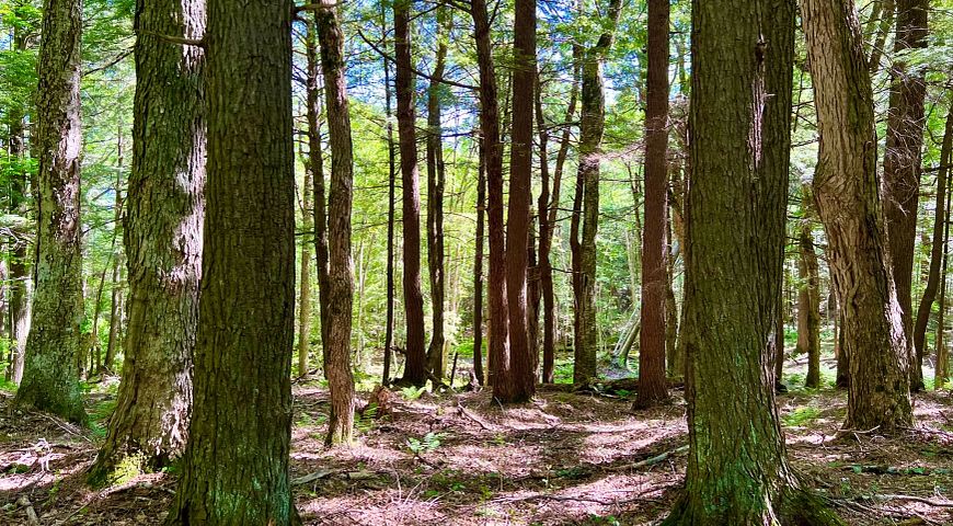
Island Lake Hemlocks State Natural Area
Planning Update
The North Central Forest Proposed Regional Master Plan was approved by the Wisconsin Natural Resources Board (NRB) at the Board’s April 15, 2026 meeting.
- Executive summary (11 MB) [PDF]
- Full plan document with maps (290 MB) [PDF]
- Full plan document without maps (31 MB) [PDF]
- Maps only (259 MB) [PDF]
A final, archived version of the plan will be made available here, after appropriate changes to formatting are completed.
The map below shows the location of many of the properties in this planning process. Click the map below to read about the properties and management considerations for each. If the map is not loading, please be sure your pop-up blocker is turned off.
Access a full-screen version of the Interactive Map of North Central Forest Regional Master Plan Properties.
Additional Documents
Ecological Characteristics And Management Opportunities
The North Central Forest Ecological Landscape is 9,543 square miles in size, comprising 17% of the land area of Wisconsin (DNR, 2015b).
Landforms in the landscape are characterized by moraines. Kettle depressions are widespread and steep. Bedrock-controlled ridges are found in the northern portion of the North Central Forest. Two topographically prominent areas in the North Central Forest are the Penokee-Gogebic Iron range in the north, and Timm’s Hill, the highest point in Wisconsin (at 1,951 feet) in the south of the region. Drumlins are important landforms in some parts of the North Central Forest (DNR, 2015b).
The North Central Forest is among the coldest of all the ecological landscapes. The mean annual snowfall is 63 inches. However, heavier snowfall can occur closer to Lake Superior, especially in the northwestern part of the ecological landscape in the topographically higher Penokee-Gogebic Iron Range. The mean growing season of the North Central Forest is the shortest season of all the ecological landscapes. Summer temperatures can be cold or freezing at night in low-lying areas, limiting the occurrence of biota (DNR, 2015b).
The cool temperatures and short growing season are not conducive to supporting agricultural row crops, such as corn, in most parts of the ecological landscape. Only 6% of the North Central Forest is in agricultural use. The climate is especially favorable for the growth of forests, which cover approximately 75% of the ecological landscape. The mesic northern hardwood forest is dominant, made up of sugar maple, basswood and red maple, with some stands containing scattered hemlock, yellow birch, and/or eastern white pine pockets (DNR, 2015b).
The North Central Forest offers the following important ecological management opportunities:
- Northern Mesic Forest
- Ephemeral Ponds
- Forested and Non-forested Wetlands
- Forested Watersheds, River Headwaters and Lakes
- Northern Dry-mesic and Boreal Forest
- Bedrock Features
Ecological Characteristics and Management Opportunities [PDF]
Recreation Resources And Opportunities
Given the abundance of lakes, streams and flowages in the North Central Forest, it is not surprising that many boaters, paddlers and fishing enthusiasts are attracted from around the Midwest. In addition to the water features in the region, the large amount of public land helps to make the region a very popular vacation and outdoor recreation destination. The uplands draw hunters, wildlife watchers, snowmobile and ATV riders, off-road bikers, skiers and horseback riders. Additional opportunities for backpacking, canoe camping and rustic tent camping in the more remote, large blocks of public land could be pursued. This is one of the best areas in the state to provide a diverse set of long-distance and loop trails for both motorized and nonmotorized forms of recreation. The regions contain trails on rail corridors that connect small towns, as well as trails in more challenging and varied terrain (DNR, 2018b).
Socioeconomic And Cultural Context
The socioeconomic and cultural contexts of a region must be considered in any planning process. While this plan focuses on resource and recreation management of the properties, these underlying contexts are important in understanding the needs of the public when planning the properties of the North Central Forest (NCF) Ecological Landscape. The demographic and economic data reported here are for the 20 counties that make up the NCF Ecological Landscape: Ashland, Barron, Bayfield, Chippewa, Clark, Douglas, Florence, Forest, Iron, Langlade, Lincoln, Marinette, Oconto, Oneida, Price, Rusk, Sawyer, Taylor, Vilas and Washburn counties.
Public Involvement
Initial Public Scoping
The DNR held a scoping public input period for the properties included in the North Central Forest Regional Master Plan. During the input period, the public was invited to share its thoughts on opportunities, challenges and topics that should be addressed regarding DNR properties in this planning process.
Two in-person public open house meetings were held, the first on July 26 in Rhinelander, Wisconsin, and the second on July 27 in Phillips, Wisconsin.
Additional Planning Resources