Central Sand Hills Ecological Landscape
Regional Master Plan
The department is developing a master plan for properties it manages in the Central Sand Hills region, which includes all of Marquette County and portions of Adams, Columbia, Dane, Green Lake, Portage, Sauk, Waupaca, Waushara and Winnebago counties.
The department manages almost 92,000 acres of land in the region in a series of parks, natural areas, fish and wildlife areas and a variety of other types of properties including fish hatcheries, the Poynette Game Farm, water access sites and parcels acquired under different statewide authorities. Some of the more popular properties that will be part of this master plan include Devil’s Lake and Hartman Creek state parks; fishery areas along the Mecan, Pine, White and Willow rivers; Grand River Marsh, Germania, Lawrence Creek and White River Marsh wildlife areas; Observatory Hill, Parfrey’s Glen and Gibraltar Rock natural areas; and portions of the Ice Age Trail.
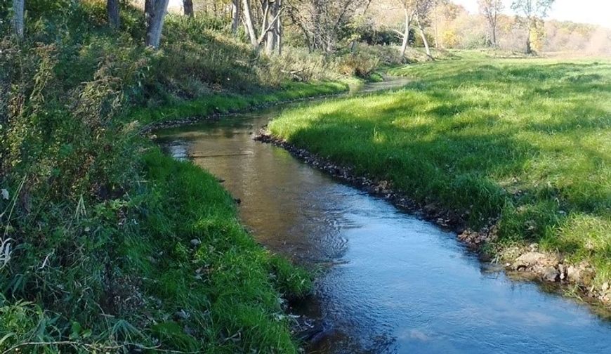 Rowan Creek Fishery Area
Planning Update
A public comment period on the Draft Vision, Goals, Objectives and Management Alternatives [PDF] ran from Sept. 18 to Nov. 2, 2023. The department received input by letter, email, hardcopy forms and an online input form, which are provided here:
The department’s summary of the comments and description of the input process are provided here:
The department appreciates the public's interest in the regional planning process and the time people took to convey their perspectives on the use and management of the DNR properties in the Central Sand Hills region.
Staff have now turned to the task of developing the Draft Master Plan.
The map below shows the location of many of the properties in this planning process. Of the properties included, 15 have master plans that were recently approved and developed under the current planning process described in administrative code (ch. NR 44, Wis. Admin. Code). The development of this CSH master plan will be an opportunity to make adjustments, if any are needed, to the management of these properties. There are 52 properties without a master plan or with plans developed before the current NR 44 process was instituted; these properties will be the focus of this planning effort.
Click the map below to read about the properties and management considerations for each.
Access a full-screen version of the Interactive Map Of Central Sand Hills Regional Master Plan Properties. If the map is not loading, please be sure your pop-up blocker is turned off.
About the Central Sand Hills Ecological Landscape
To provide background, the department has prepared brief profiles of the larger, more popular properties included in this master plan along with information about the ecological, recreation and socioeconomic characteristics of the broader region within which the properties are located. The entire document can be viewed here:
The department developed a 20-minute presentation explaining the planning process and some general information about the properties included in this master plan and the broader region.
Portions of the document related to different topics can be viewed below.
Ecological Characteristics And Management Opportunities
The Central Sand Hills region is located in central Wisconsin, encompassing all of Marquette County and portions of Adams, Columbia, Dane, Green Lake, Portage, Sauk, Waupaca, Waushara and Winnebago counties. It encompasses 2,170 square miles (1,388,705 acres), representing 3.9% of the area of the state of Wisconsin.
The landforms in this ecological landscape include a series of glacial moraines: the Johnstown Moraine is the terminal moraine of the Green Bay Lobe; the Arnott Moraine is older and has more subdued topography. Pitted outwash is extensive in some areas. Glacial tunnel channels occur here (for example, in Waushara County, just east of and visible from Interstate 39). Bedrock exposures are limited but include Precambrian rhyolite bluffs and a vertical exposure of Ordovician St. Peter sandstone with a thin dolomite cap at Gibraltar Rock in Columbia County. Soils are primarily sands with organic soils underlying wetlands such as tamarack swamps and sedge meadows. Muck farming (on drained peatlands) occurs in some areas. Although the climate is suitable for agricultural row crops, small grains and pastures, the sandy soils limit agricultural potential in some areas.
Numerous springs and coldwater streams that support robust populations of trout emanate from the end moraine near the western boundary of the Central Sand Hills. Wetland communities associated with these glacial landforms include fen, sedge meadow, low prairie, shrub swamp and tamarack swamp. Some of these wetlands are alkaline and differ in composition from those found in the more acid environments to the west in the Central Sand Plains Ecological Landscape.
Large wetland complexes, such as those found at Germania Marsh, Comstock Marsh, Grand River Marsh, Fountain Creek Prairie and Lunch Creek, contain good examples of natural communities such as fen, sedge meadow, wet prairie, shrub swamp, marsh and tamarack swamp. Some seepage lakes and ponds exhibit dramatic natural water level fluctuations that create important inland beach and coastal plain marsh habitats. The CSH EL contains more occurrences of the globally rare coastal plain marsh community than any other landscape in Wisconsin.
The Wisconsin River and a short but ecologically important stretch of the lower Baraboo River flow through this ecological landscape. Other important rivers include the Fox, Grand, Mecan, Montello, Puchyan and White. Large impoundments occur on the Wisconsin (Lake Wisconsin), Fox (Buffalo Lake and Lake Puckaway) and Grand (Grand River Marsh) rivers.
Fire, the dynamic force responsible for shaping and maintaining much of the forest, savanna, prairie and some wetland vegetation in the Central Sand Hills, has been all but eliminated from the present ecological landscape. Dams, dikes, ditches and groundwater withdrawals have altered the abundance, composition and structure of many wetland communities as well as the hydrologic regimes that supported them.
Outstanding ecological management opportunities in the Central Sand Hills include:
- Fire-adapted ecosystems;
- Coastal plain marsh and inland beach (associated with soft-water seepage lake or pond);
- Coldwater streams, springs and spring runs;
- Alkaline wetlands;
- Warmwater rivers and floodplain corridors;
- Lakes, ponds and impoundments; and
- Bedrock features - cliffs, talus slopes and bedrock glades.
The department's Natural Heritage Conservation (NHC) program conducted an Ecological Assessment [PDF] of DNR properties in the region that have outdated or no existing master plans.
Ecological Characteristics And Management Opportunities [PDF]
Recreation Resources And Opportunities
This ecological landscape, especially due to the southern portion’s close proximity to Madison and the northeastern portion’s convenience to the Fox Valley, has the potential to help meet growing demand for a variety of recreational activities. Properties and trails that provide hiking, off-road bicycling, bird watching, horseback riding, cross-country skiing, hunting and fishing are in high demand in this part of the state and could likely be established in several places here.
Notable recreation opportunities in this region include:
- Devils Lake State Park
- Hartman Creek State Park
- Trout angling
- Warmwater angling and boating
- Large wetland complexes
The five counties that comprise the bulk of the CSH (Columbia, Green Lake, Marquette, Portage, and Waushara) have over 124,000 acres of land open to the public for different types of outdoor recreation. In addition, many of the lands owned by land trusts and other conservation organizations allow public access. Together, these lands provide a range of opportunities.
Socioeconomic And Cultural Context
The socioeconomic and cultural contexts of a region are important to understand in developing the master plan. While this plan focuses on resource and recreation management of the properties, the underlying social, economic and cultural contexts are important in understanding the needs of the public when planning the future use of properties. The data included here focus on the five counties that comprise the majority of the Central Sand Hills region: Columbia, Green Lake, Marquette, Portage and Waushara counties.
Some of the highlights include:
- Land use: Currently, land cover is one-third agricultural crops, a little more than one-third forest, and smaller amounts of grasslands, open wetlands, open water and urban areas. Large contiguous areas of major natural or surrogate vegetation types are uncommon; the prevalent land cover pattern is a mosaic of small to medium-sized patches of natural, agricultural and residential lands.
- The region has 79 square miles of surface water, 84% of which is in lakes and flowages.
- Almost 125,000 acres of land are estimated to be open to the public for recreation in the region, which represents 4% of the land area.
- The five-county area has an estimated population of 187,000 residents.
Additional Considerations for Planning And Management
In addition to the information presented earlier in this document, other examples of factors that are anticipated to affect the quality and type of habitats and the public uses of DNR lands in the Central Sand Hills – and the department’s management of these properties – include the following:
- Invasive species
- Population and land use changes
- Climate change
- Water resources
Maps
Public Involvement
The department recognizes the value and importance of public involvement in developing effective master plans for properties it manages. During the planning process, the department listens to many voices, including recreation users, commercial interests, neighboring landowners, conservation groups, elected officials, other government agencies, tribal representatives and other interested parties. The Public Involvement Plan describes the opportunities that the public can provide input in the planning process.
The department sought initial public ideas, perspectives and comments on the current and future recreational uses and habitat management actions at DNR properties in the region. Over 300 responses were received, all of which are posted here. DNR staff reviewed the comments and prepared a summary of the input and major themes.
The department’s master planning process includes three phases and provides opportunities for public input at each phase. The following document describes the steps in the planning process.