Central Lake Michigan Coastal
Regional Master Plan
The department is initiating a regional master planning process for the Central Lake Michigan Coastal Ecological Landscape, which includes much of Brown, Calumet, Kewaunee, Manitowoc, Outagamie, Sheboygan, Ozaukee and Waupaca counties, as well as portions of Door, Milwaukee, Oconto, Shawano and Winnebago counties.
The Central Lake Michigan Coastal Ecological Landscape includes state parks, trails, natural areas, wildlife areas, fishery areas and forests. The landscape is over 2,700 square miles in size, located along Lake Michigan's shoreline and west of Green Bay, encompassing the Lower Wolf River corridor. Collins Marsh Wildlife Area, Harrington Beach State Park, Kohler-Andrae State Park, Navarino Wildlife Area and Point Beach State Forest will all be included in this regional plan.
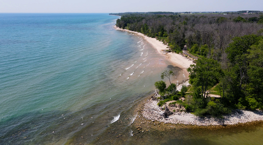
Harrington Beach State Park
Planning Update
In the summer of 2025, the DNR held a scoping public input period during which the public was invited to share their thoughts on the future use and management of DNR properties in the region and to help identify topics that should be addressed in the plan. A summary of the input received is now available.
Read the Initial Public Input Summary [PDF]
The department is now in the process of developing the Central Lake Michigan Coastal Draft Regional Master Plan. When complete, the public will have the opportunity to review and comment on the document. Click the link above to sign up to receive email updates regarding the project.
Additional questions or comments regarding this planning process may be submitted to:
Natalie Avallone, DNR Property Planner
Natalie.Avallone@wisconsin.gov
920-492-8183
The map below shows the location of many of the properties in this planning process.
Click on the map to read about the properties and management considerations for each. If the map is not loading, be sure your pop-up blocker is turned off.
Access a full-screen version of the Interactive Map of Central Lake Michigan Coastal Regional Master Plan Properties.
Ecological Characteristics And Management Opportunities
The Central Lake Michigan Coastal Ecological Landscape is 2,742 square miles, representing 4.9% of the area of the state of Wisconsin. Within the region, only about 3% of land is publicly owned. The Ecological Landscape stretches from southern Door County west across Green Bay to the Wolf River drainage, then southward in a narrowing strip along the Lake Michigan shoreline to central Milwaukee County.
The Region is defined by three prominent features: the Niagara Escarpment and associated bedrock formations, the Lake Michigan shoreline and associated natural communities and the Lower Wolf River's associated floodplain and tributaries. Notably, the Region also provides critical habitat for migratory birds, wintering and nesting birds.
The Region holds 175 miles of Lake Michigan shoreline. The proximity to the lake has impacted the Region's climate and landscape. The coastal area is defined by beaches and dunes, ridge-and-swale complexes, alvar communities, clay seepage bluffs and ravines, coastal forests and marshes and migratory bird concentration areas. Several large river systems run through the Region, including the Lower Wolf River and its associated tributaries, as well as the Ahnapee, Kewaunee, East and West Twin, Manitowoc, Sheboygan and Milwaukee rivers.
The Niagara Escarpment is a bedrock formation extending along the east sides of lower Green Bay, Lake Winnebago and the Fox River Valley. Dolomites and shales underlie the glacial deposits covering nearly the entire ecological landscape. Silurian dolomite frequently appears as ridges and cliffs where the surrounding bedrock has been eroded, providing critical habitat for rare terrestrial snails, bats and specialized plants.
A large floodplain forest occurs along virtually the entire Lower Wolf River corridor and much of the Embarrass River corridor, making up the greatest acreage of floodplain forest in eastern Wisconsin. This is also one of the last large, continuous and intact floodplain communities in the Midwest and connects to extensive northern forested landscapes, including the Menominee Forest and the Chequamegon-Nicolet National Forest, both outside the Central Lake Michigan Coastal Ecological Landscape. Included in the Wolf and Embarrass River floodplain forests are southern hardwood swamps, alder thicket, shrub carr, southern and northern sedge meadows, emergent marshes, and numerous warm water rivers and streams. The forests are dominated by silver maple, green ash and swamp white oak. Impacts from the invasive emerald ash borer in recent years have led to large-scale ash dieback across the region's southern hardwood swamps.
Historically, much of the landscape was vegetated with mesic hardwood forest. Most of the upland forest has since been removed and converted to agricultural, residential and industrial uses. The agricultural industry of the Central Lake Michigan Coastal Region is very productive, with the highest per-acre production of dairy and the second-highest per-acre market value. Prominent urbanized areas, including the cities of Green Bay, Appleton, Manitowoc, Mequon, Sheboygan and the northernmost part of Milwaukee, have led to high levels of developed land in the Central Lake Michigan Coastal Ecological Landscape, including extensive development along the Lake Michigan Coastline.
The Central Lake Michigan Coastal Ecological Landscape offers the following important ecological opportunities:
- Lake Michigan Shoreline
- Lower Green Bay
- Lower Wolf River Corridor
- Niagara Escarpment
- Interior Hardwood and Conifer Swamps
- Migratory, Wintering, and Nesting Birds
- Ephemeral Ponds
Recreation Resources And Opportunities
Lake Michigan, Green Bay and the tributaries to these waterbodies are the backbone of recreation in the region. The shoreline along Lake Michigan and Green Bay is exceedingly popular for boating, fishing and sailing in the summer, while ice-fishing, snowmobiling and cross-country skiing draw visitors in the winter. Point Beach State Forest, Kohler-Andrae State Park and Harrington Beach State Park are all on the coast of Lake Michigan and provide a variety of recreational opportunities, including hiking, bicycling, camping, canoe/kayaking, horseback riding, fishing, swimming and beach walking.
Glacial formations, the Niagara Escarpment and Lake Michigan coastal ridge and swale geology create landforms popular for hiking, bicycling, horseback riding, hunting, nature study and cross-country skiing. The beaches, dunes and clay seepage bluffs along parts of the Lake Michigan coast also create unique vistas and recreation opportunities that are difficult to find in other parts of Wisconsin.
Nature study and bird watching is popular in areas along the Lake Michigan coastline and the Lower Wolf River due to the presence of migratory birds, including raptors and a wide variety of waterfowl. Brillion, Collins Marsh and Kewaunee Wildlife Areas are situated near the headwaters of the Manitowoc River and are notable for their large marshes and wetlands, important for migrating and nesting habitats for waterfowl, waterbirds, marsh birds and passerine birds. Opportunities for hunting and trapping also exist throughout the region, with waterfowl and deer hunting as significant draws, especially on properties located within the Lower Wolf River floodplain.
Recreational trails are abundant in the Region. Popular destinations include the Lake Michigan State Water Trail and the Ice Age National Scenic Trail, as well as numerous state and local multi-use trails, including the Ahnapee, Fox River, Friendship, and Newton Blackmour State Trails.
Socioeconomic And Cultural Context
Socioeconomic and cultural contexts are important in understanding the needs of the public when planning the properties in the Central Lake Michigan Coastal Ecological Landscape. Due to the method by which economic and cultural data is collected and made available, the context given here is for the entirety of the counties substantially intersected by the Central Lake Michigan Coastal Ecological Landscape, rather than for the landscape itself. Those counties are Brown, Calumet, Kewaunee, Manitowoc, Outagamie, Ozaukee, Sheboygan and Waupaca. Other counties that intersect with the region include Door, Milwaukee, Oconto, Shawano and Winnebago.
- Land use: currently, land cover in the CLMC is dominated by agriculture with lesser amounts of forests, wetland and developed areas.
- The CLMC has a low proportion of land (approximately 3%) in public ownership.
- The CLMC has an estimated population of around 875,000, approximately 15% of the population of Wisconsin.
- The CLMC has a significant maritime history.
Public Involvement
The DNR will be holding a scoping public input period for the properties included in the Central Lake Michigan Coastal Regional Master Plan in summer 2025. During this public input period, residents can provide feedback related to existing facilities as well as identify opportunities and challenges associated with the DNR lands within the region. The public will be invited to an in-person public meeting (presentation and open house) the evening of Aug. 13, 2025, or may attend daytime office hours on either Aug. 12, 2025, or Aug. 13, 2025, to share their thoughts on the opportunities, challenges, topics and general condition of the DNR properties included in this planning process.
In addition to the public meeting and office hours, the public will have the opportunity to submit feedback through surveys associated with the CLMC region and its properties. The surveys will be available in-person (during the public meeting) or online during the public input period. Although the department accepts comments and feedback regarding its properties anytime, this public input period is the primary means to submit public comments regarding the creation of the CLMC regional master plan.
Maps
Additional Planning Resources
- CLMC Regional and Property Analysis [PDF]
- List of properties to be planned (CLMC) [PDF]
- CLMC Property Profile Pages [PDF]
- Chapter 8: Central Lake Michigan Coastal Ecological Landscape [PDF]
- Rapid Ecological Assessments
- Wolf River Basin Biotic Inventory and Analysis [PDF]
- Rapid Ecological Assessment for the Eastern Lake Winnebago Wildlife Areas [PDF]
- Rapid Ecological Assessment for the Door and Kewaunee County State Wildlife and Natural Areas Planning Group [PDF]
- Rapid Ecological Assessment for the Central Lake Michigan Coastal Ecological Landscape [PDF]
- Recreation Opportunities Analysis [PDF]
- Wisconsin Statewide Comprehensive Outdoor Recreation Plan [PDF]