Grant-Platte/Sugar-Pecatonica Basin Management
The Grant-Platte/Sugar-Pecatonica basin is actually two basins clumped together for the purposes of planning for and managing the resources.
Water quality in the Grant-Platte/Sugar-Pecatonica basin is generally fair to good. The primary water quality problems are the result of nonpoint sources of pollution, particularly from agricultural operations and urban runoff - excessive populations of rough fish and hydrologic modifications such as dams, stream straightening and ditching, draining or other alterations of wetlands.
The lack of base or recent data is a significant problem for managing the water resources of this basin. There is not adequate water chemistry, habitat or sediment data to make sound water resources management decisions for many streams, lakes and flowages in the basin. Basin assessment monitoring, however, will only fill data holes on some of the most important water resources in the basin.
Data management also hampers the management of the basin. Water resources information is scattered among various electronic and paper files. Basin planning and water resources management would be aided by better data management including a user-friendly, decentralized, computerized water resources database and geographical information system (GIS).
General Information
The Grant-Platte/Sugar-Pecatonica basin drains approximately 1,860 square miles in southwestern Wisconsin. This includes all or parts of five counties. Major streams in the basin in addition to the Sugar and Pecatonica rivers are the Little Sugar River, East branch Pecatonica River, West branch Pecatonica River, Raccoon Creek and Mineral Point branch.
The basin has more than 1,720 miles of streams. The existing biological use of about 260.6 miles of those streams is coldwater sport fishery (trout) waters. Another 517.6 miles are warmwater sport fishery waters while 215 miles are considered valuable forage fishery streams.
The DNR lacks existing use classification information for more than 706.9 of the total stream miles in the Sugar-Pecatonica basin. Most of these stream miles are from small, unnamed tributaries or the headwater areas of named streams above the reaches for which DNR has information.
The existing biological use or stream classification information for many of the streams is old or sketchy and additional monitoring is needed to update the surface water database. Potential uses are not being met on about 12.5% of stream miles in the basin. We estimate another 28% of stream miles only partially meet their potential use. Nonpoint sources of pollution are likely the main factors for the partial attainment of potential biological uses.
The Grant-Platte/Sugar-Pecatonica basin lies in the Driftless Area of the state, an area not covered by the last glacier. Soils in the Driftless Area are generally moderately to excessively well-drained mineral soils that have a high mineral content and low organic matter content. Farming occurs on the ridgetops or in the stream valleys with the region's steep hillsides often left wooded. Streams in the Driftless Area have a higher gradient than those in other parts of southern Wisconsin. Wetlands usually only occur along stream and river margins. While there are some larger wetland complexes along the Pecatonica and Sugar rivers, the percentage of wetland to upland areas in the basin is significantly less than for basins outside the Driftless Area.
Streams in the Sugar-Pecatonica basin support several rare fish species that are declining within their range. Effective nonpoint source controls are essential to the protection of these species.
Agriculture predominates land use in the basin, with urbanizing areas closer to Madison. The basin drains the rapidly developing southwest side of Madison. About 10 million people live within a three-hour drive of the basin. Besides portions of the city of Madison, larger municipalities in the basin include Verona, Monroe, parts of Fitchburg, Mt. Horeb, Dodgeville and Darlington. The proximity to major population centers often places heavy pressure on aquatic and water-related resources.
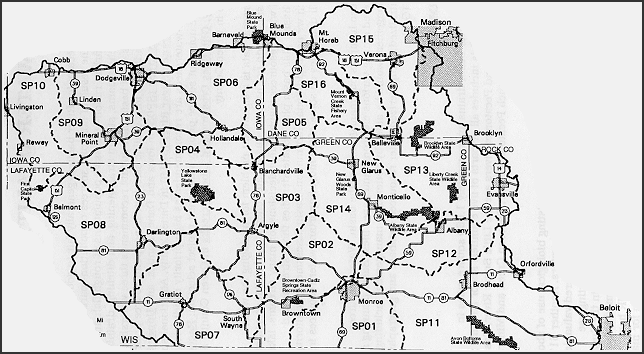
Basin Map
There are 16 watersheds or sub-watersheds in the Sugar-Pecatonica basin.
Click on the map below to find out more about each watershed (or use the links below the map).
- Honey and Richland creeks
- Jordan and Skinner creeks
- Lower East branch Pecatonica River
- Yellowstone River
- Gordon Creek
- Upper East branch Pecatonica River
- Lower Pecatonica River
- Middle Pecatonica River
- Mineral Point branch
- Upper West branch Pecatonica River
- Lower Sugar River
- Lower Middle Sugar River
- Allen Creek and Middle Sugar River
- Little Sugar River
- Upper Sugar River
- West branch Sugar River and Mount Vernon Creek
Dane County Regional Planning Commission
The Dane County Regional Planning Commission (DCRPC) is presently the designated planning agency for water resources in Dane County. This includes all or parts of five watersheds in the Grant-Platte/Sugar-Pecatonica basin: Gordon Creek, West branch Sugar River and Mt. Vernon Creek, Upper Sugar River, Little Sugar River and Allen Creek and Middle Sugar River watersheds.
DCRPC prepared a water quality management plan for Dane County as part of its delegated responsibilities. The Dane County water quality management plan and its updated appendices contain various water resources related recommendations. That plan also describes in more detail than this document the water resources in the Dane County portions of the Sugar-Pecatonica basin. The DCRPC plan should be consulted for proposed projects or actions that may affect water resources.
The water quality management plan makes further recommendations for actions the DNR intends to undertake or would like to see completed in the Dane County watersheds depending upon resources available.
Lakes
The Grant-Platte/Sugar-Pecatonica basin has few lakes. Almost all the lakes in the basin are impoundments of streams. These impoundments were often created to provide water power to drive small grist mills, although the more recent ones were created to provide recreational and/or residential opportunities. Impoundment lakes typically have a large drainage area to lake area ratio. They are usually shallow and subject to rapid sedimentation. Six water quality problems frequently limit recreational use of millponds: turbidity, excessive rooted aquatic plants and attached algae, free-floating blue-green algae, roughfish, water level fluctuation and winterkills (Marshall, 1988). These water quality problems, coupled with the generally small size of the lakes, limit uses of the lakes.