Badfish Creek Wildlife Area
Badfish Creek Wildlife Area is located in Dane County, about 3 miles southwest of Stoughton and 3 miles southeast of Oregon. This property currently consists of 1,147 acres of state-owned land and 287 acres of leased land.
This property can be reached from Madison by taking Highway 14 south, going east on Highway A and passing the Anthony Branch Fisheries and Wildlife Area, then taking your first right on Oak Ridge Road to continue to follow the boundary of the fisheries area. This road dead-ends at Old Stone Road. Take Old Stone Road until you get to Badfish Creek Wildlife Area.
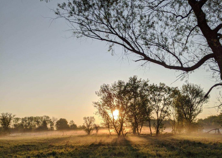
The property is mainly wetland, although there are smaller areas of grassland and hardwood forest. The property is bisected by Badfish Creek, and several agricultural ditches can make access challenging. However, a pedestrian bridge across Badfish Creek allows access to either side of the creek. There is a Class II dog training area on the northeast side of the property.
Highlights of the Badfish Creek Wildlife Area include several wetland scrapes that provide habitat to waterfowl and other wetland species, as well as a high-quality wet prairie in the southwest portion of the property that includes natural springs.
With the help of the Friends of Badfish Creek Watershed, there are two maintained canoe/kayak launches on the property at the north and south ends. Although there are no maintained trails on the property, there are several access lanes that are used by hikers. These lanes are mowed with the help of the Friends of Badfish Creek but may not always be maintained.
Friends Groups
Many groups have stepped up to the challenge of supporting Badfish Creek Wildlife Area. The U.S. Fish and Wildlife Service staff and waterfowl stamp dollars helped provide the waterfowl scrapes. The Stoughton Conservation Club graciously helped finish the project when budgets were low. Recently, the Dane County Conservation League has taken an interest in the property and hopes to help with funding and volunteer habitat work. The Friends of Badfish Creek Watershed is a group focusing on the creek in the adjoining area. To lend a hand, visit the Friends Groups' websites.
Management Objectives
The property was acquired in the 1970s from Stoughton Farms. The cropped areas were planted to tall-grass prairie in the northern fields along Old Stone Road. The interior upland fields are predominantly cool-season grass. A large percentage of the property is wetland, and many acres are covered with reed canary grass and ragweed. There are desirable sedge communities in the southwestern corner and western side of the property.
With grant funding and a partnership with Ducks Unlimited, wetland restoration work has been done to restore some of the natural hydrology in the area. This has included creating wetland scrapes and blocking some agricultural ditches on the property. The DNR conducts prescribed burns on the property and invasive brush control to help improve grassland and wetland habitat.
Recreation
Badfish Creek Wildlife Area offers many recreational opportunities:
- Birding
- Canoeing (landing at the northern parking lot)
- Class II dog training area*
- Cross-country skiing (no designated trail)
- Fishing
- Hiking (no designated trail)
- Hunting (especially noted for waterfowl, deer, turkey and stocked pheasant)
- Kayaking
- Trapping
- Wildlife viewing
We are trying to remove box elder along the roads. Contact the manager if you have an interest in a firewood permit.
*Note: Dogs must be leashed from April 15 to July 31.
Amenities
- Bathroom - None.
- Parking lot - Yes, there are five parking lots.
- Campground and size - None.
- Trails, Types and Lengths - No official trails are maintained for public use; only staff access lanes are mowed for fire breaks or other management.
- Other amenities - There are two canoe/kayak launches.
Maps
There are three parking lots on this northern boundary. You can then follow the outskirts of the property by turning right (south) and follow Danks Road along the eastern side of the property. There is one small parking lot on this road. Danks Road dead-ends at Old Stage Road. Turn right (west) and Old Stage Road follows the southern boundary. A DNR parking lot is located a 1/3-mile west of the last intersection, which takes you to a few small fields and a bit of oak woods. Taking the next right or heading north on Lake Kegonsa Road will allow you to skirt the western portion of the property. There is no public access to this property from the west. Remember, stay clear of the private land and respect their property rights. Enjoy the property!
Disclaimer: The DNR cannot guarantee the usage of every parking lot, as parking lots can close suddenly and for a variety of reasons. Weather, local water levels and county road closures may impact parking lot availability.
Download a map of this property.
If you are interested in exploring this property further, you can also access an interactive map.


