Hampden Wetland Public Hunting Grounds

Hampden Wetland Public Hunting Grounds is a 229-acre property located in Columbia County. Find it by taking Highway 60 for 6 miles west from Columbus to Highway A, then south on A for 4 miles to Arnold Road.
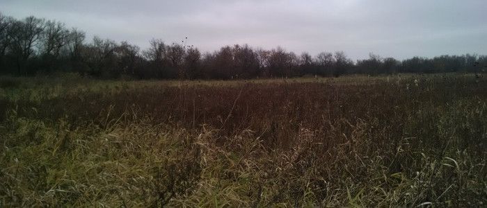
The department began acquiring land for this public hunting ground in 1966. Much of the property is marshy potholes with lowland timber.
Management Objectives
The Hampden Wetland Public Hunting Grounds are primarily managed as a wetland complex to provide opportunities for hunting, trapping and wildlife watching. Habitat management is aimed at maintaining and restoring native flora to the property. Dependent upon funding, the management techniques employed may include prescribed fire, grazing, brushing, mowing and other invasive species removal efforts.
Master Plan
The Columbia County master plan, completed in 2012, guides the long-term management of this property. Progress toward achieving the goals of the master plan is tracked through annual monitoring reports.
The Natural Resources Board approved the new master plan in December 2012 for this property and 19 other state fish and wildlife properties and associated state natural areas. These properties are primarily located in Columbia County, but portions lie within Dane, Marquette, and Sauk counties.
Visit the property planning for more information on master planning for this and other wildlife areas around the state.
Recreation
The Hampden Wetland Public Hunting Grounds offers many recreational opportunities:
- Birding
- Cross-country skiing (no designated trail)
- Hiking (no designated trail)
- Dogs must be kept on a leash of no longer than 8ft from April 15 to July 31.
- Hunting (especially noted for turkey [Zone 2] and deer)
- Snowshoeing (no designated trail)
- Trapping
- Wild edibles/gathering
- Wildlife viewing
Amenities
- Bathroom - none.
- Parking lot - there is one parking area available.
- Campground and size - none.
- Trails, Types and Lengths - non-designated only.
Maps
Download a map of this property.
Map L Series: Public Hunting Grounds and Remnant Fishery Area
If you are interested in exploring this property further, you can access an interactive map.
Find out more about how to adopt this wildlife area.

