Scuppernong River Habitat Area
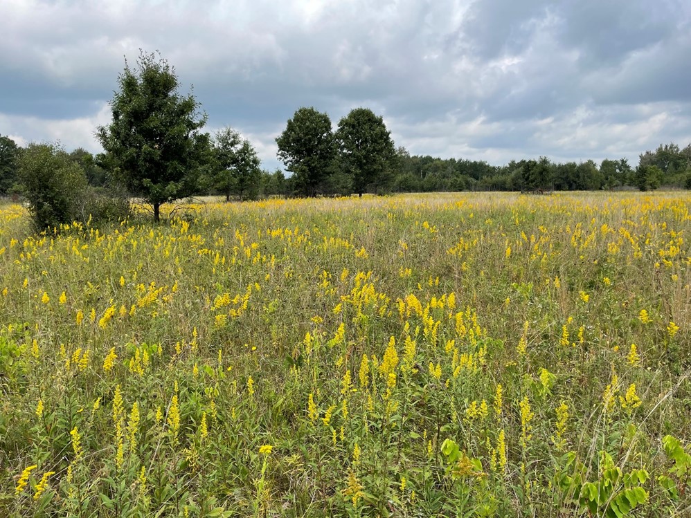
Scuppernong River Habitat Area is the largest wet prairie east of the Mississippi, at over 2,000 acres. The property consists of wetlands, wet prairie, mesic prairie and hardwood forest. Scuppernong Creek flows through it.
The property is located within the Kettle Moraine State Forest-Southern Unit, 1 mile northwest of Eagle in Waukesha County. Access is off of State Highway 59, State Highway 67, County Highway N and County Highway ZZ.
Management Objectives
Kettle Moraine Low Prairie State Natural Area and Scuppernong Prairie State Natural Area are located within the boundaries of the Scuppernong Habitat Area. Many rare plants, birds and invertebrates are located here. In the last 15 years, controlled burns and brush cutting have opened up the landscape, and many sedge meadows and wet prairie species have reasserted themselves. Hunting and viewing opportunities include many migratory songbirds, stocked pheasants, deer, small game, turkey, furbearers and sandhill cranes.
Recreation
The Scuppernong River Habitat Area offers many recreational opportunities:
- Birding
- Canoeing
- Cross-country skiing (no designated trail)
- Fishing
- Hiking (Ice Age Trail and Scuppernong Springs Nature Trails, as well as non-designated trails)
- Hunting (noted for: deer and pheasants)
- Trapping
- Wild edibles/gathering
- Wildlife viewing
Amenities
- Bathroom - none.
- Parking lot - yes.
- Campground and size - Adjacent use areas like Ottawa Lake Campground, have amenities. These are not owned or managed by DNR.
- Trails, Types and Lengths - Ice Age Trail, Scuppernong Springs Nature Trails, and non-designated trails.
Maps
If you are interested in exploring this property further, you can access an interactive map.
Find out more about how to adopt this wildlife area.


