Beaver Brook Wildlife Area
Beaver Brook is a 1,964-acre property located in southeast Washburn County. Because it is nestled between the cities of Shell Lake and Spooner, visitors can experience an outdoor adventure during the day and still make it back to town for dinner. This beautiful wildlife area is home to adventurous hunting, including deer, turkey, bear and ruffed grouse. It is also one of the state’s premier Class 1 brook and brown trout streams. Enjoy a day of birding in a variety of habitat types, a hike or ski on the rustic trails with a dog or simply sit by the water and listen to the frogs. The public artesian well along County B is a popular stop for many locals who come with their gallon jugs for water and then continue onto the property for berry picking.
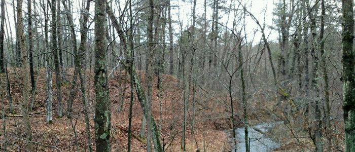
Beaver Brook is fed along its course by ten spring ponds and many banks seep and flow into the Yellow River. Harrison Lake is 17 acres and lies at the north end of the property; Lutz Lake is 18 acres and is on the south end. Habitat types include red oaks, aspen, mixed hardwoods, upland and lowland brush, swamp hardwood and conifer, tamarack, pine and open fields make up the other habitats of the wildlife area.
Beaver Brook Wildlife Area is less than one mile southeast of Spooner. Access points include Wildlife Road off Highway 253, Randall Lake Road and Beaverbrook Ave off Highway 70 in Spooner, Cranberry Road, Wildcat Road off Highway 53, and from Highway B. Carry-in access to Harrison Lake is on Wildlife Road.
History
Beaver Brook Wildlife Area was established in 1951 through the acquisition of 680 acres from Washburn County to protect and manage this great fishery and surrounding wildlife habitat. Ten more purchases occurred that have bringing the total acreage to 1,964 acres. The 2003 addition of 560 acres was added to the property by the DNR and Wisconsin Department of Transportation as part of a wetland mitigation project that restored the cranberry beds and associated flow. Trout are once again present in this stretch of the brook. Remnants of several homesteads can be found on the property and remnants of an old logging dam built in 1870 and removed in 1910 are still visible near the mouth of Beaver Brook.
Management objective
Wildlife management and related non-motorized recreation are the primary goals and uses for the property. Many in-stream trout habitat improvements and surveys are conducted on the trout stream. Regular aspen, oak and pine management timber sales are conducted to improve wildlife habitat.
State natural area designation was recommended for a 240-acre portion, which contains the most botanically diverse site known in the Northwest Sands Ecological Landscape. The cranberry beds and associated flows have been restored to a trout stream and wetlands.
A railroad grade, which is now the Wild River Recreation Trail, runs parallel to the west side of the wildlife area and is open for running, hiking, biking, horseback riding, dog sledding, ATV riding, snowmobiling and cross-country skiing. Users are asked to stay on the designated trail to ensure future use. The wildlife area is also home to 5 miles of cross-country ski and hiking trails, accessible from the end of Randall Lake Road on the north end of Spooner or a parking lot on Cranberry Road, as well as many miles of other gated trails for quiet, quality recreational experiences.
Recreation
Beaver Brook Wildlife Area offers many recreational opportunities:
- Birding
- Cross-country skiing (designated trail; dogs permitted, and grooming begins after archery deer season ends)
- Fishing
- Hiking (no designated trail; all dogs must be kept on a leash from April 15-July 31)
- Hunting
- Snowshoeing
- Trapping
- Wild edibles/gathering
- Wildlife viewing
Amenities
- Bathroom - none.
- Parking lot - Parking areas are located 1 mile southwest of Hwy 53 on Cranberry Dr. and on Wildlife Road east of Hwy 253.
- Campground and size - none.
- Trails, Types and Lengths - Cross-country ski trails groomed by the local ski club.
- Other amenities - A very popular artesian well site with the best water in the area can be found on the south end of the property, accessible by a gravel walkway on the north side of Highway B.
Maps
Download a map of this property.
If you are interested in exploring this property further, you can access an interactive map.

Find out more about how to adopt this wildlife area.