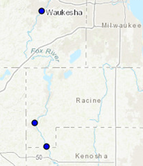
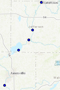
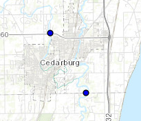
Flood Inundation Mapping
Do you live near the Rock River, Upper Fox River, Cedar Creek, Milwaukee River, or Wisconsin River? New interactive maps can help you predict when your property may flood. The maps show where flooding may occur over a range of river levels and are connected to real-time and forecasted river levels at stream gages. These maps will improve planning, property protection measures and evacuation options prior to floods, as well as assist in identifying cost-effective mitigation measures, thus lowering future costs in response, repair and recovery.
The Federal Emergency Management Agency funded the Wisconsin DNR, in partnership with the National Weather Service and Wisconsin Emergency Management, to produce the maps. To view the Flood Inundation Maps, click on the interactive map links below, then scroll down to the Gauge Location section and select the "Activate Partner FIM" box.